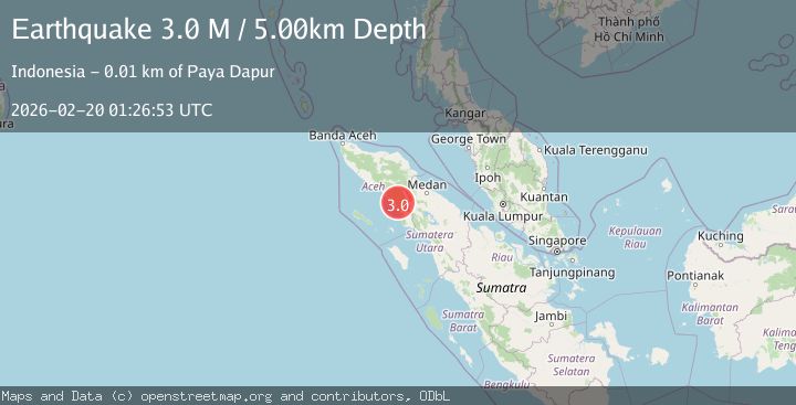
Earthquake Northern Sumatra, Indonesia
Fri, 20 Feb 2026 01:26:53 GMT
Time1 hour ago
Location
3.2087, 97.5297
Depth
5.0 KM
Event Summary
A 3.0 magnitude earthquake struck on Northern Sumatra, Indonesia, at Fri, 20 Feb 2026 01:26:53 GMT. Depth: 5km. Reviewed by BMKG seismologists, this minor quake occurred at a magnitude type of M.
Magnitude
3.0
M
Source
BMKG
Intensity
-
Agency Reports
1 Sources| Source | Magnitude | Depth | Time |
|---|---|---|---|
| BMKGPrimary | 3.0 | 5 km | 1 hour ago |
Earthquake Details
ManualEvent IDbmg2026dnma
Tsunami PotentialNo
Magnitude TypeM
Nearest Places
- Gampong Pucuk Lembang7.8 km
- Tinggi8.5 km
- Kecamatan Kluet Timur9.1 km
- Bukit Panji10.3 km
- Gampong Lawe Sawah11.7 km
Comments
Join the discussion about this event.
Latest Earthquakes
2.9Mag
Salta, Argentina
Time1 hour ago
Depth296.51 km
SourceVYT (Automatic)
2.4Mag
Sumbawa Region, Indonesia
Time1 hour ago
Depth20.31 km
SourceBMKG
1.2Mag
3 km N of The Geysers, CA
Time1 hour ago
Depth1.73 km
SourceUSGS (Automatic)
2.2Mag
Central Alaska
Time1 hour ago
Depth9.77 km
SourceVYT (Automatic)
2.3Mag
Sulawesi, Indonesia
Time1 hour ago
Depth0.00 km
SourceVYT (Automatic)
Nearby Earthquakes
2.4Mag
Northern Sumatra, Indonesia
Time1 week ago
Depth67.73 km
SourceBMKG (Automatic)
5.0Mag
NORTHERN SUMATRA, INDONESIA
Time20 years ago
Depth33.00 km
SourceEMSC (Automatic)
2.9Mag
NORTHERN SUMATRA, INDONESIA
Time1 month ago
Depth18.00 km
SourceBMKG (Automatic)
3.0Mag
NORTHERN SUMATRA, INDONESIA
Time3 years ago
Depth48.00 km
SourceDJA (Automatic)
3.0Mag
NORTHERN SUMATRA, INDONESIA
Time1 year ago
Depth14.00 km
SourceBMKG (Automatic)