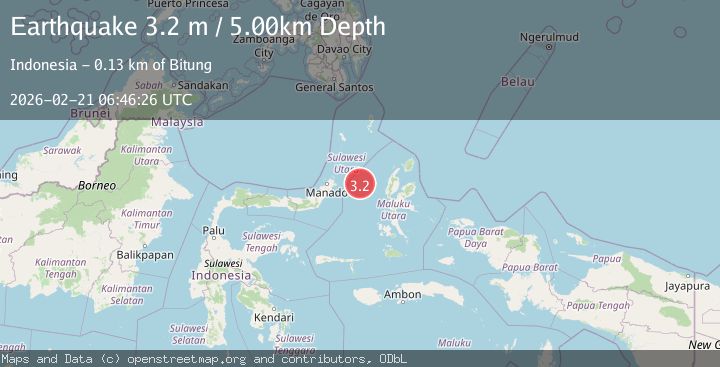
Earthquake Northern Molucca Sea
Sat, 21 Feb 2026 06:46:25 GMT
Time1 hour ago
Location
1.5216, 126.2647
Depth
5.0 KM
Event Summary
A 3.1 magnitude earthquake struck on Northern Molucca Sea, at Sat, 21 Feb 2026 06:46:25 GMT. Depth: 4.985386km. Reviewed by BMKG seismologists, this minor quake occurred at a magnitude type of M.
Magnitude
3.1
M
Source
BMKG
Intensity
-
Agency Reports
1 Sources| Source | Magnitude | Depth | Time |
|---|---|---|---|
| BMKGPrimary | 3.1 | 5 km | 1 hour ago |
Earthquake Details
ManualEvent IDbmg2026dpsb
Tsunami PotentialNo
Magnitude TypeM
Nearest Places
- 24.0 km
- 24.1 km
- 24.5 km
- 25.7 km
- 25.8 km
Comments
Join the discussion about this event.
Latest Earthquakes
2.3Mag
Poland
Time1 hour ago
Depth3.05 km
SourceVYT (Automatic)
2.8Mag
Colombia-Venezuela border region
Time1 hour ago
Depth138.55 km
SourceVYT (Automatic)
2.7Mag
Bali Sea
Time1 hour ago
Depth17.45 km
SourceBMKG
2.2Mag
Southern California
Time1 hour ago
Depth3.91 km
SourceVYT (Automatic)
2.5Mag
18 km W of Delta, B.C., MX
Time1 hour ago
Depth10.16 km
SourceUSGS (Automatic)
Nearby Earthquakes
3.0Mag
MOLUCCA SEA
Time1 year ago
Depth34.00 km
SourceBMKG (Automatic)
3.0Mag
MOLUCCA SEA
Time1 year ago
Depth34.00 km
SourceBMKG (Automatic)
5.2Mag
MOLUCCA SEA
Time19 years ago
Depth2.00 km
SourceEMSC (Automatic)
3.0Mag
MOLUCCA SEA
Time7 months ago
Depth29.00 km
SourceBMKG (Automatic)
3.5Mag
MOLUCCA SEA
Time1 month ago
Depth41.00 km
SourceBMKG (Automatic)