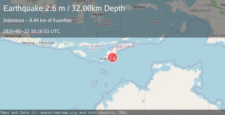
Earthquake Timor Region
Sun, 22 Feb 2026 16:16:53 GMT
Time1 hour ago
Location
-10.4084, 124.4691
Depth
24.4 KM
Event Summary
A 2.3 magnitude earthquake struck on Timor Region, at Sun, 22 Feb 2026 16:16:53 GMT. Depth: 24.392471km. Reviewed by BMKG seismologists, this minor quake occurred at a magnitude type of M.
Magnitude
2.3
M
Source
BMKG
Intensity
-
Agency Reports
1 Sources| Source | Magnitude | Depth | Time |
|---|---|---|---|
| BMKGPrimary | 2.3 | 24 km | 1 hour ago |
Earthquake Details
ManualEvent IDbmg2026dsgk
Tsunami PotentialNo
Magnitude TypeM
Nearest Places
- 27.9 km
- 29.5 km
- 31.6 km
- 31.6 km
- 31.6 km
Comments
Join the discussion about this event.
Latest Earthquakes
3.6Mag
Gulf of Alaska
Time1 hour ago
Depth645.39 km
SourceVYT (Automatic)
2.6Mag
Bali region, Indonesia
Time1 hour ago
Depth11.23 km
SourceVYT (Automatic)
0.8Mag
Alaska Peninsula
Time1 hour ago
Depth0.00 km
SourceVYT (Automatic)
2.6Mag
Norway-Russia border region
Time1 hour ago
Depth470.46 km
SourceVYT (Automatic)
1.6Mag
Southeastern Alaska
Time1 hour ago
Depth9.28 km
SourceVYT (Automatic)
Nearby Earthquakes
2.9Mag
TIMOR REGION, INDONESIA
Time1 month ago
Depth31.00 km
SourceBMKG (Automatic)
2.5Mag
TIMOR REGION, INDONESIA
Time1 month ago
Depth5.00 km
SourceBMKG (Automatic)
2.5Mag
TIMOR REGION, INDONESIA
Time1 week ago
Depth38.00 km
SourceBMKG (Automatic)
2.5Mag
Timor Region
Time1 week ago
Depth38.38 km
SourceBMKG
2.5Mag
TIMOR REGION, INDONESIA
Time1 month ago
Depth26.00 km
SourceBMKG (Automatic)