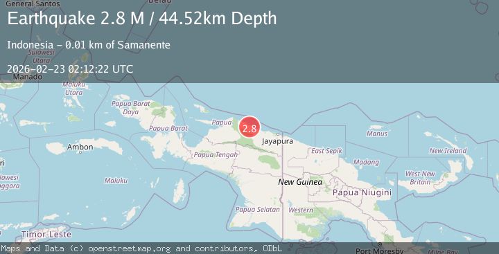
Earthquake West Papua, Indonesia
Mon, 23 Feb 2026 02:12:21 GMT
Time1 hour ago
Location
-2.0499, 138.9356
Depth
55.3 KM
Event Summary
A 2.7 magnitude earthquake struck on West Papua, Indonesia, at Mon, 23 Feb 2026 02:12:21 GMT. Depth: 55.265419km. Reviewed by BMKG seismologists, this minor quake occurred at a magnitude type of M.
Magnitude
2.7
M
Source
BMKG
Intensity
-
Agency Reports
1 Sources| Source | Magnitude | Depth | Time |
|---|---|---|---|
| BMKGPrimary | 2.7 | 55 km | 1 hour ago |
Earthquake Details
ManualEvent IDbmg2026dtaa
Tsunami PotentialNo
Magnitude TypeM
Nearest Places
- 2.1 km
- 5.5 km
- 5.8 km
- 5.9 km
- 7.5 km
Comments
Join the discussion about this event.
Latest Earthquakes
3.4Mag
western Texas
Time1 hour ago
Depth0.00 km
SourceVYT (Automatic)
1.7Mag
Sumbawa region, Indonesia
Time1 hour ago
Depth0.00 km
SourceVYT (Automatic)
4.6Mag
SOUTH OF FIJI ISLANDS
Time1 hour ago
Depth531.30 km
SourceNEIC (Automatic)
2.1Mag
ISLAND OF HAWAII, HAWAII
Time1 hour ago
Depth10.40 km
SourceHV (Automatic)
2.3Mag
Southeastern Alaska
Time1 hour ago
Depth0.00 km
SourceVYT (Automatic)
Nearby Earthquakes
5.0Mag
PAPUA, INDONESIA
Time13 years ago
Depth40.00 km
SourceEMSC (Automatic)
3.4Mag
PAPUA, INDONESIA
Time1 month ago
Depth15.00 km
SourceBMKG (Automatic)
5.1Mag
PAPUA, INDONESIA
Time6 months ago
Depth5.40 km
SourceEMSC (Automatic)
4.0Mag
PAPUA, INDONESIA
Time6 years ago
Depth10.00 km
SourceDJA (Automatic)
3.0Mag
NEAR N COAST OF PAPUA, INDONESIA
Time6 months ago
Depth22.00 km
SourceBMKG (Automatic)