Earthquake Minahassa Peninsula, Sulawesi
Thu, 26 Feb 2026 10:37:11 GMT
Time1 hour ago
Location
-0.5525, 121.8104
Depth
5.5 KM
Event Summary
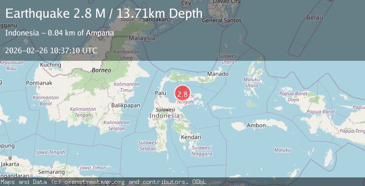
A 2.7 magnitude earthquake struck on Minahassa Peninsula, Sulawesi, at Thu, 26 Feb 2026 10:37:11 GMT. Depth: 5.547388km. Reviewed by BMKG seismologists, this minor quake occurred at a magnitude type of M.
Magnitude
2.7
M
Source
BMKG
Intensity
-
Agency Reports
1 Sources| Source | Magnitude | Depth | Time |
|---|---|---|---|
| BMKGPrimary | 2.7 | 6 km | 1 hour ago |
Earthquake Details
ManualEvent IDbmg2026dzde
Tsunami PotentialNo
Magnitude TypeM
Nearest Places
- 3.0 km
- 4.1 km
- 5.3 km
- 6.5 km
- 7.3 km
Comments
Join the discussion about this event.
Latest Earthquakes
2.5Mag
near the coast of southern Peru
Time1 hour ago
Depth79.96 km
SourceVYT (Automatic)
3.4Mag
Minahasa, Sulawesi, Indonesia
Time1 hour ago
Depth7.93 km
SourceVYT (Automatic)
2.4Mag
Timor Region
Time1 hour ago
Depth0.52 km
SourceBMKG
4.7Mag
Antofagasta, Chile
Time1 hour ago
Depth117.31 km
SourceVYT (Automatic)
1.8Mag
6 km SSW of Pāhala, Hawaii
Time1 hour ago
Depth30.11 km
SourceUSGS (Automatic)
Nearby Earthquakes
5.0Mag
SULAWESI, INDONESIA
Time7 years ago
Depth10.00 km
SourceEMSC (Automatic)
3.4Mag
SULAWESI, INDONESIA
Time2 months ago
Depth7.00 km
SourceBMKG (Automatic)
3.0Mag
SULAWESI, INDONESIA
Time4 years ago
Depth10.00 km
SourceDJA (Automatic)
3.0Mag
SULAWESI, INDONESIA
Time1 year ago
Depth10.00 km
SourceBMKG (Automatic)
3.6Mag
SULAWESI, INDONESIA
Time1 month ago
Depth10.00 km
SourceBMKG (Automatic)