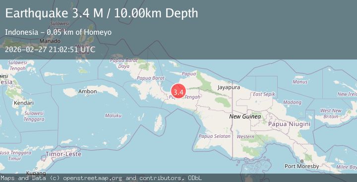
Earthquake West Papua, Indonesia
Fri, 27 Feb 2026 21:02:52 GMT
Time1 hour ago
Location
-3.2897, 136.2157
Depth
10.0 KM
Event Summary
A 3.2 magnitude earthquake struck on West Papua, Indonesia, at Fri, 27 Feb 2026 21:02:52 GMT. Depth: 10km. Reviewed by BMKG seismologists, this minor quake occurred at a magnitude type of M.
Magnitude
3.2
M
Source
BMKG
Intensity
-
Agency Reports
1 Sources| Source | Magnitude | Depth | Time |
|---|---|---|---|
| BMKGPrimary | 3.2 | 10 km | 1 hour ago |
Earthquake Details
ManualEvent IDbmg2026ebtj
Tsunami PotentialNo
Magnitude TypeM
Nearest Places
- 7.4 km
- 10.6 km
- 12.8 km
- 16.6 km
- 18.8 km
Comments
Join the discussion about this event.
Latest Earthquakes
3.7Mag
Salta, Argentina
Time1 hour ago
Depth422.36 km
SourceVYT (Automatic)
1.2Mag
WESTERN TURKEY
Time1 hour ago
Depth5.60 km
SourceAFAD (Automatic)
3.9Mag
Timor region, Indonesia
Time1 hour ago
Depth10.00 km
SourceVYT (Automatic)
2.9Mag
SAN JUAN, ARGENTINA
Time1 hour ago
Depth97.00 km
SourceNSNA (Automatic)
2.6Mag
Tarapaca, Chile
Time1 hour ago
Depth94.73 km
SourceVYT (Automatic)
Nearby Earthquakes
5.3Mag
PAPUA, INDONESIA
Time20 years ago
Depth40.00 km
SourceEMSC (Automatic)
2.9Mag
West Papua, Indonesia
Time1 week ago
Depth10.00 km
SourceBMKG
3.2Mag
West Papua, Indonesia
Time1 week ago
Depth29.40 km
SourceBMKG
4.0Mag
PAPUA, INDONESIA
Time3 years ago
Depth10.00 km
SourceDJA (Automatic)
2.5Mag
West Papua, Indonesia
Time2 days ago
Depth10.00 km
SourceBMKG