Earthquake Minahassa Peninsula, Sulawesi
Mon, 02 Mar 2026 19:02:05 GMT
Time4 hours ago
Location
1.1824, 120.7870
Depth
10.0 KM
Event Summary
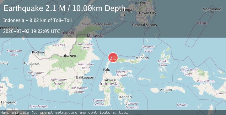
A 2.1 magnitude earthquake struck on Minahassa Peninsula, Sulawesi, at Mon, 02 Mar 2026 19:02:05 GMT. Depth: 10km. Reviewed by BMKG seismologists, this minor quake occurred at a magnitude type of M.
Magnitude
2.1
M
Source
BMKG
Intensity
-
Agency Reports
1 Sources| Source | Magnitude | Depth | Time |
|---|---|---|---|
| BMKGPrimary | 2.1 | 10 km | 4 hours ago |
Earthquake Details
ManualEvent IDbmg2026ehbw
Tsunami PotentialNo
Magnitude TypeM
Nearest Places
- 1.7 km
- 2.1 km
- 2.6 km
- 2.7 km
- 3.1 km
Comments
Join the discussion about this event.
Latest Earthquakes
1.1Mag
3 km ENE of Moreno Valley, CA
Time4 hours ago
Depth13.86 km
SourceUSGS (Automatic)
1.1Mag
4 km NW of The Geysers, CA
Time4 hours ago
Depth3.17 km
SourceUSGS (Automatic)
2.6Mag
western Texas
Time4 hours ago
Depth2.32 km
SourceVYT (Automatic)
1.1Mag
5 km NW of The Geysers, CA
Time4 hours ago
Depth3.27 km
SourceUSGS (Automatic)
4.2Mag
OFFSHORE ARAUCANIA, CHILE
Time4 hours ago
Depth10.00 km
SourceCSN (Automatic)
Nearby Earthquakes
2.0Mag
Minahassa Peninsula, Sulawesi
Time1 day ago
Depth8.65 km
SourceBMKG
2.2Mag
Minahassa Peninsula, Sulawesi
Time1 day ago
Depth5.00 km
SourceBMKG
4.0Mag
MINAHASA, SULAWESI, INDONESIA
Time1 year ago
Depth20.00 km
SourceBMKG (Automatic)
2.3Mag
Minahassa Peninsula, Sulawesi
Time1 day ago
Depth6.35 km
SourceBMKG
3.0Mag
MINAHASA, SULAWESI, INDONESIA
Time3 months ago
Depth17.00 km
SourceBMKG (Automatic)