Earthquake Northern Sumatra, Indonesia
Tue, 03 Mar 2026 22:11:17 GMT
Time2 hours ago
Location
1.5079, 97.8476
Depth
10.0 KM
Event Summary
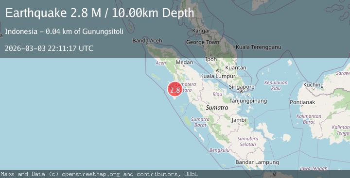
A 2.8 magnitude earthquake struck on Northern Sumatra, Indonesia, at Tue, 03 Mar 2026 22:11:17 GMT. Depth: 10km. Reviewed by BMKG seismologists, this minor quake occurred at a magnitude type of M.
Magnitude
2.8
M
Source
BMKG
Intensity
-
Agency Reports
1 Sources| Source | Magnitude | Depth | Time |
|---|---|---|---|
| BMKGPrimary | 2.8 | 10 km | 2 hours ago |
Earthquake Details
ManualEvent IDbmg2026ejdp
Tsunami PotentialNo
Magnitude TypeM
Nearest Places
- 34.3 km
- 34.4 km
- 34.5 km
- 35.3 km
- 35.4 km
Comments
Join the discussion about this event.
Latest Earthquakes
0.9Mag
Southern Alaska
Time1 hour ago
Depth8.91 km
SourceVYT (Automatic)
2.3Mag
Poland
Time1 hour ago
Depth7.57 km
SourceVYT (Automatic)
1.1Mag
12 km SSW of San Lucas, CA
Time1 hour ago
Depth12.27 km
SourceUSGS (Automatic)
1.4Mag
6 km N of San Dimas, CA
Time1 hour ago
Depth13.71 km
SourceUSGS (Automatic)
1.5Mag
30 km NW of Toyah, Texas
Time2 hours ago
Depth4.17 km
SourceUSGS (Automatic)
Nearby Earthquakes
5.7Mag
NIAS REGION, INDONESIA
Time10 years ago
Depth40.00 km
SourceEMSC (Automatic)
6.2Mag
NIAS REGION, INDONESIA
Time20 years ago
Depth10.00 km
SourceEMSC (Automatic)
5.4Mag
NIAS REGION, INDONESIA
Time11 years ago
Depth38.00 km
SourceEMSC (Automatic)
5.4Mag
NORTHERN SUMATRA, INDONESIA
Time9 years ago
Depth50.00 km
SourceEMSC (Automatic)
3.0Mag
NORTHERN SUMATRA, INDONESIA
Time3 years ago
Depth10.00 km
SourceDJA (Automatic)