Earthquake Southern Sumatra, Indonesia
Wed, 04 Mar 2026 14:21:46 GMT
Time8 hours ago
Location
-1.4692, 99.8284
Depth
27.0 KM
Event Summary
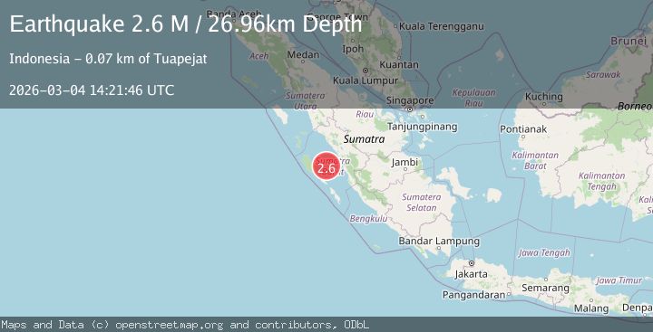
A 2.6 magnitude earthquake struck on Southern Sumatra, Indonesia, at Wed, 04 Mar 2026 14:21:46 GMT. Depth: 26.961805km. Reviewed by BMKG seismologists, this minor quake occurred at a magnitude type of M.
Magnitude
2.6
M
Source
BMKG
Intensity
-
Agency Reports
1 Sources| Source | Magnitude | Depth | Time |
|---|---|---|---|
| BMKGPrimary | 2.6 | 27 km | 8 hours ago |
Earthquake Details
ManualEvent IDbmg2026ekjq
Tsunami PotentialNo
Magnitude TypeM
Nearest Places
- 36.6 km
- 36.7 km
- 51.7 km
- 56.4 km
- 59.9 km
Comments
Join the discussion about this event.
Latest Earthquakes
2.0Mag
Timor Region
Time8 hours ago
Depth56.89 km
SourceBMKG
1.1Mag
Southern Alaska
Time8 hours ago
Depth31.74 km
SourceVYT (Automatic)
2.4Mag
Sumba Region, Indonesia
Time8 hours ago
Depth30.29 km
SourceBMKG
1.9Mag
San Juan, Argentina
Time8 hours ago
Depth0.00 km
SourceVYT (Automatic)
1.9Mag
7 km NE of Calexico, CA
Time8 hours ago
Depth12.53 km
SourceUSGS (Automatic)
Nearby Earthquakes
6.1Mag
KEP. MENTAWAI REGION, INDONESIA
Time20 years ago
Depth10.00 km
SourceEMSC (Automatic)
2.9Mag
KEP. MENTAWAI REGION, INDONESIA
Time1 month ago
Depth12.00 km
SourceBMKG (Automatic)
5.4Mag
KEP. MENTAWAI REGION, INDONESIA
Time20 years ago
Depth33.00 km
SourceEMSC (Automatic)
6.0Mag
KEP. MENTAWAI REGION, INDONESIA
Time20 years ago
Depth33.00 km
SourceEMSC (Automatic)
5.5Mag
KEP. MENTAWAI REGION, INDONESIA
Time18 years ago
Depth29.00 km
SourceEMSC (Automatic)