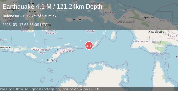
Earthquake Tanimbar Islands Region, Indonesia
Tue, 17 Mar 2026 05:33:08 GMT
Time3 weeks ago
Location
-7.9740, 130.1719
Depth
121.2 KM
Event Summary
A 4.1 magnitude earthquake struck on Tanimbar Islands Region, Indonesia, at Tue, 17 Mar 2026 05:33:08 GMT. Depth: 121.237511km. Reviewed by BMKG seismologists, this light quake occurred at a magnitude type of M.
Magnitude
4.1
M
Source
BMKG
Intensity
I
Agency Reports
1 Sources| Source | Magnitude | Depth | Time |
|---|---|---|---|
| BMKGPrimary | 4.1 | 121 km | 3 weeks ago |
Earthquake Details
ManualEvent IDbmg2026fhls
QualityS
Tsunami PotentialNo
Magnitude TypeM
Last Update3 weeks ago
Felt Reports0
Did you feel this earthquake? Report it to help others.
No reports yet
Be the first to report this earthquake!
Latest Earthquakes
Loading...
Nearby Earthquakes
3.2Mag
Kepulauan Tanimbar, Indonesia
Time12 hours ago
Depth207.89 km
SourceVYT (Automatic)
3.0Mag
Kepulauan Tanimbar, Indonesia
Time2 days ago
Depth599.24 km
SourceVYT (Automatic)
3.5Mag
Kepulauan Tanimbar, Indonesia
Time3 days ago
Depth135.01 km
SourceVYT (Automatic)
3.1Mag
Banda Sea
Time4 days ago
Depth205.20 km
SourceVYT (Automatic)
3.7Mag
Kepulauan Tanimbar, Indonesia
Time4 days ago
Depth109.74 km
SourceVYT (Automatic)