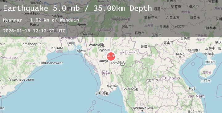
Earthquake MYANMAR
Thu, 15 Jan 2026 12:12:18 GMT
Time2 hours ago
Location
21.1326, 96.0348
Depth
10.0 KM
Event Summary
A 4.9 magnitude earthquake struck on MYANMAR, at Thu, 15 Jan 2026 12:12:18 GMT. Depth: 10km. Reviewed by EMSC seismologists, this light quake occurred at a magnitude type of mb.
Magnitude
4.9
mb
Source
EMSC
Intensity
-
Agency Reports
2 Sources| Source | Magnitude | Depth | Time |
|---|---|---|---|
| EMSCPrimary | 4.9 | 10 km | 2 hours ago |
| USGS | 4.9 | 10 km | 2 hours ago |
Earthquake Details
AutomaticEvent IDemsc_20260115_0000182
Tsunami PotentialNo
Magnitude Typemb
Nearest Places
- Myay Taing Kan1.8 km
- Pwemingyi Kondan1.9 km
- Zagyangon2.5 km
- Se2.5 km
- Nyaung Pin Thar2.5 km
Comments
Join the discussion about this event.
Latest Earthquakes
2.5Mag
Minahassa Peninsula, Sulawesi
Time1 hour ago
Depth112.29 km
SourceBMKG (Automatic)
4.1Mag
Banda Sea
Time1 hour ago
Depth235.66 km
SourceBMKG (Automatic)
1.4Mag
WESTERN TURKEY
Time2 hours ago
Depth7.50 km
SourceEMSC (Automatic)
2.5Mag
SYRIA
Time2 hours ago
Depth15.90 km
SourceKOERI (Automatic)
3.1Mag
COOK STRAIT, NEW ZEALAND
Time2 hours ago
Depth45.00 km
SourceGNS (Automatic)
Nearby Earthquakes
No significant earthquakes nearby recently.