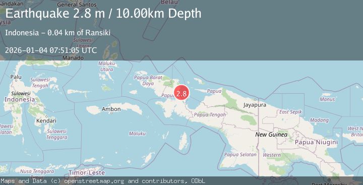
Earthquake NEAR N COAST OF PAPUA, INDONESIA
Sun, 04 Jan 2026 07:51:05 GMT
Time1 month ago
Location
-1.8900, 134.3000
Depth
10.0 KM
Event Summary
A 2.8 magnitude earthquake struck on NEAR N COAST OF PAPUA, INDONESIA, at Sun, 04 Jan 2026 07:51:05 GMT. Depth: 10km. Reviewed by BMKG seismologists, this minor quake occurred at a magnitude type of m.
Magnitude
2.8
m
Source
BMKG
Intensity
-
Agency Reports
1 Sources| Source | Magnitude | Depth | Time |
|---|---|---|---|
| BMKGPrimary | 2.8 | 10 km | 1 month ago |
Earthquake Details
AutomaticEvent IDemsc_BMKG_20260104_0000100
Tsunami PotentialNo
Magnitude Typem
Nearest Places
- Kampung Isenebuay12.6 km
- Senebuai13.0 km
- Distrik Rumberpon14.2 km
- Pulau Rumberpon15.0 km
- Jalia15.0 km
Comments
Join the discussion about this event.
Latest Earthquakes
2.4Mag
Finland
Time2 minutes ago
Depth301.88 km
SourceVYT (Automatic)
1.2Mag
Alaska Peninsula
Time3 minutes ago
Depth0.12 km
SourceVYT (Automatic)
4.1Mag
NEAR COAST OF NORTHERN PERU
Time8 minutes ago
Depth35.00 km
SourceLIM (Automatic)
3.1Mag
DODECANESE IS.-TURKEY BORDER REG
Time9 minutes ago
Depth4.10 km
SourceKOERI (Automatic)
2.6Mag
NEAR COAST OF NICARAGUA
Time14 minutes ago
Depth38.00 km
SourceINET (Automatic)
Nearby Earthquakes
2.5Mag
West Papua Region, Indonesia
Time2 weeks ago
Depth10.00 km
SourceBMKG (Automatic)
4.0Mag
NEAR N COAST OF PAPUA, INDONESIA
Time4 years ago
Depth77.00 km
SourceDJA (Automatic)
5.0Mag
NEAR N COAST OF PAPUA, INDONESIA
Time4 years ago
Depth40.00 km
SourceEMSC (Automatic)
2.5Mag
NEAR N COAST OF PAPUA, INDONESIA
Time1 month ago
Depth18.00 km
SourceBMKG (Automatic)
5.2Mag
NEAR N COAST OF PAPUA, INDONESIA
Time13 years ago
Depth30.00 km
SourceEMSC (Automatic)