Earthquake SOUTHERN SUMATRA, INDONESIA
Tue, 06 Jan 2026 11:05:05 GMT
Time1 month ago
Location
-2.2000, 101.0900
Depth
58.0 KM
Event Summary
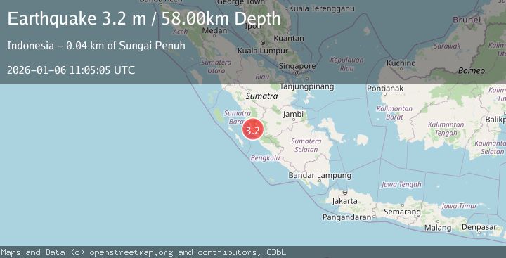
A 3.2 magnitude earthquake struck on SOUTHERN SUMATRA, INDONESIA, at Tue, 06 Jan 2026 11:05:05 GMT. Depth: 58km. Reviewed by BMKG seismologists, this minor quake occurred at a magnitude type of m.
Magnitude
3.2
m
Source
BMKG
Intensity
-
Agency Reports
1 Sources| Source | Magnitude | Depth | Time |
|---|---|---|---|
| BMKGPrimary | 3.2 | 58 km | 1 month ago |
Earthquake Details
AutomaticEvent IDemsc_BMKG_20260106_0000196
Tsunami PotentialNo
Magnitude Typem
Nearest Places
- Sungai Kumbunggedang2.3 km
- Nagari Dusun Baru Tapan2.5 km
- Pondokbaru2.8 km
- Kumbung2.9 km
- Pondokdurian3.1 km
Comments
Join the discussion about this event.
Latest Earthquakes
1.8Mag
Southeastern Alaska
Time2 minutes ago
Depth0.00 km
SourceVYT (Automatic)
2.6Mag
northern Alaska
Time3 minutes ago
Depth206.30 km
SourceVYT (Automatic)
2.7Mag
Alaska Peninsula
Time14 minutes ago
Depth7.08 km
SourceVYT (Automatic)
2.4Mag
HAWAII REGION, HAWAII
Time16 minutes ago
Depth11.20 km
SourceHV (Automatic)
3.1Mag
Potosi, Bolivia
Time20 minutes ago
Depth330.08 km
SourceVYT (Automatic)
Nearby Earthquakes
3.0Mag
SOUTHERN SUMATRA, INDONESIA
Time3 years ago
Depth42.00 km
SourceDJA (Automatic)
2.5Mag
Southern Sumatra, Indonesia
Time3 weeks ago
Depth15.39 km
SourceBMKG (Automatic)
3.0Mag
KEP. MENTAWAI REGION, INDONESIA
Time7 months ago
Depth54.00 km
SourceBMKG (Automatic)
3.0Mag
KEP. MENTAWAI REGION, INDONESIA
Time2 years ago
Depth44.00 km
SourceBMKG (Automatic)
3.0Mag
SOUTHERN SUMATRA, INDONESIA
Time2 years ago
Depth37.00 km
SourceBMKG (Automatic)