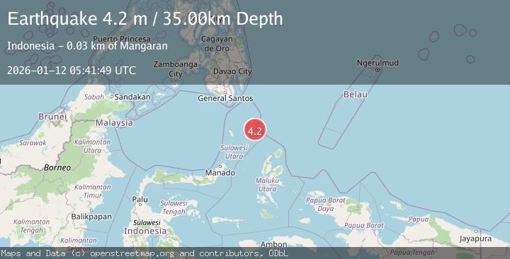
Earthquake KEPULAUAN TALAUD, INDONESIA
Mon, 12 Jan 2026 05:41:49 GMT
Time1 month ago
Location
3.7800, 127.0300
Depth
35.0 KM
Event Summary
A 4.2 magnitude earthquake struck on KEPULAUAN TALAUD, INDONESIA, at Mon, 12 Jan 2026 05:41:49 GMT. Depth: 35km. Reviewed by BMKG seismologists, this light quake occurred at a magnitude type of m.
Magnitude
4.2
m
Source
BMKG
Intensity
-
Agency Reports
1 Sources| Source | Magnitude | Depth | Time |
|---|---|---|---|
| BMKGPrimary | 4.2 | 35 km | 1 month ago |
Earthquake Details
AutomaticEvent IDemsc_BMKG_20260112_0000082
Tsunami PotentialNo
Magnitude Typem
Nearest Places
- Tanjung Tampida20.1 km
- Tanjung Tatimbalangan21.5 km
- Akas21.7 km
- Desa Damau Bowone21.9 km
- Damau22.2 km
Comments
Join the discussion about this event.
Latest Earthquakes
3.6Mag
Offshore Crete, Greece
Time6 minutes ago
Depth76.42 km
SourceVYT (Automatic)
1.8Mag
Southeastern Alaska
Time13 minutes ago
Depth0.49 km
SourceVYT (Automatic)
1.8Mag
British Columbia, Canada
Time14 minutes ago
Depth0.00 km
SourceVYT (Automatic)
2.0Mag
SAN FRANCISCO BAY AREA, CALIF.
Time14 minutes ago
Depth18.40 km
SourceNC (Automatic)
2.2Mag
Sumbawa Region, Indonesia
Time15 minutes ago
Depth176.31 km
SourceBMKG
Nearby Earthquakes
3.2Mag
Talaud Islands, Indonesia
Time3 weeks ago
Depth32.03 km
SourceBMKG (Automatic)
5.8Mag
KEPULAUAN TALAUD, INDONESIA
Time17 years ago
Depth60.00 km
SourceEMSC (Automatic)
4.0Mag
KEPULAUAN TALAUD, INDONESIA
Time6 years ago
Depth31.00 km
SourceDJA (Automatic)
5.2Mag
KEPULAUAN TALAUD, INDONESIA
Time1 month ago
Depth29.00 km
SourceBMKG (Automatic)
4.0Mag
KEPULAUAN TALAUD, INDONESIA
Time1 year ago
Depth27.00 km
SourceBMKG (Automatic)