Earthquake MOLUCCA SEA
Mon, 12 Jan 2026 15:54:00 GMT
Time1 month ago
Location
0.7900, 125.8700
Depth
9.0 KM
Event Summary
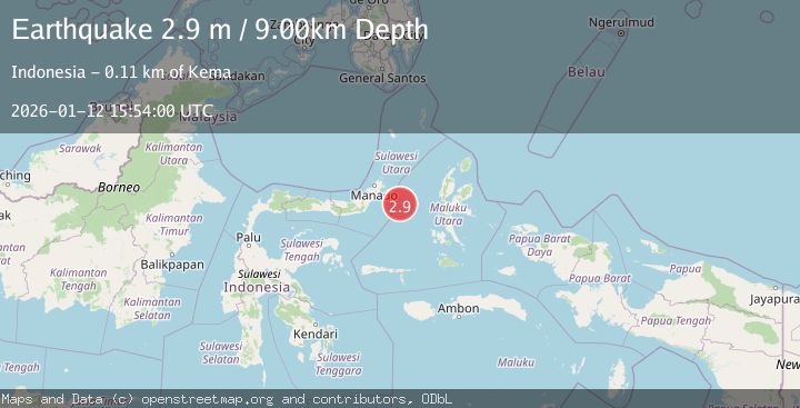
A 2.9 magnitude earthquake struck on MOLUCCA SEA, at Mon, 12 Jan 2026 15:54:00 GMT. Depth: 9km. Reviewed by BMKG seismologists, this minor quake occurred at a magnitude type of m.
Magnitude
2.9
m
Source
BMKG
Intensity
-
Agency Reports
1 Sources| Source | Magnitude | Depth | Time |
|---|---|---|---|
| BMKGPrimary | 2.9 | 9 km | 1 month ago |
Earthquake Details
AutomaticEvent IDemsc_BMKG_20260112_0000238
Tsunami PotentialNo
Magnitude Typem
Nearest Places
- Maluku Sea35.3 km
- Kelurahan Pantai Sagu36.1 km
- Pulau Tifore36.4 km
- Kelurahan Tifure36.4 km
- Pulau Gureda37.9 km
Comments
Join the discussion about this event.
Latest Earthquakes
3.5Mag
Fox Islands, Aleutian Islands, Alaska
Time5 minutes ago
Depth72.63 km
SourceVYT (Automatic)
1.8Mag
Kodiak Island region, Alaska
Time8 minutes ago
Depth208.13 km
SourceVYT (Automatic)
2.6Mag
Armenia-Azerbaijan-Iran border region
Time9 minutes ago
Depth0.00 km
SourceVYT (Automatic)
1.9Mag
Southeastern Alaska
Time11 minutes ago
Depth0.00 km
SourceVYT (Automatic)
3.4Mag
western Texas
Time13 minutes ago
Depth2.32 km
SourceVYT (Automatic)
Nearby Earthquakes
4.0Mag
MOLUCCA SEA
Time6 years ago
Depth10.00 km
SourceDJA (Automatic)
3.0Mag
MOLUCCA SEA
Time4 years ago
Depth10.00 km
SourceDJA (Automatic)
4.0Mag
MOLUCCA SEA
Time5 years ago
Depth10.00 km
SourceDJA (Automatic)
5.2Mag
MOLUCCA SEA
Time18 years ago
Depth10.00 km
SourceEMSC (Automatic)
3.0Mag
MOLUCCA SEA
Time2 months ago
Depth94.00 km
SourceBMKG (Automatic)