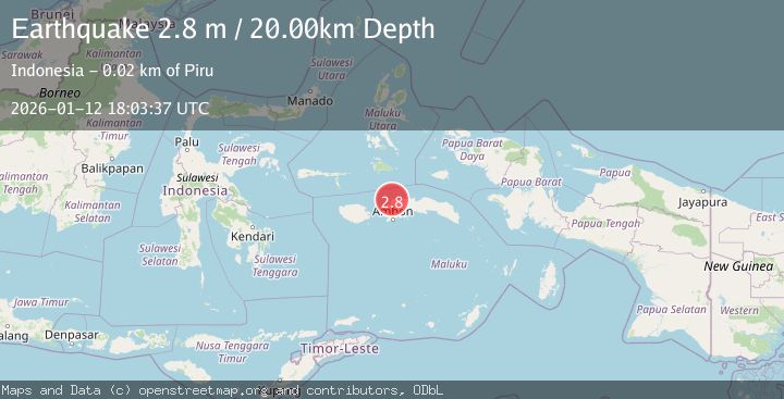
Earthquake CERAM SEA, INDONESIA
Mon, 12 Jan 2026 18:03:37 GMT
Time1 month ago
Location
-2.8600, 128.1700
Depth
20.0 KM
Event Summary
A 2.8 magnitude earthquake struck on CERAM SEA, INDONESIA, at Mon, 12 Jan 2026 18:03:37 GMT. Depth: 20km. Reviewed by BMKG seismologists, this minor quake occurred at a magnitude type of m.
Magnitude
2.8
m
Source
BMKG
Intensity
-
Agency Reports
1 Sources| Source | Magnitude | Depth | Time |
|---|---|---|---|
| BMKGPrimary | 2.8 | 24 km | 1 month ago |
Earthquake Details
AutomaticEvent IDemsc_BMKG_20260112_0000288
Tsunami PotentialNo
Magnitude Typem
Nearest Places
- Tanjung Tandurubesar0.9 km
- Tanjung Tanduru Kecil1.1 km
- Lawau2.7 km
- Tanjung Sensuraha3.8 km
- Tanjung Tanamahoni4.7 km
Comments
Join the discussion about this event.
Latest Earthquakes
2.4Mag
Finland
Time4 minutes ago
Depth301.88 km
SourceVYT (Automatic)
1.2Mag
Alaska Peninsula
Time4 minutes ago
Depth0.12 km
SourceVYT (Automatic)
4.1Mag
NEAR COAST OF NORTHERN PERU
Time9 minutes ago
Depth35.00 km
SourceLIM (Automatic)
3.1Mag
DODECANESE IS.-TURKEY BORDER REG
Time10 minutes ago
Depth4.10 km
SourceKOERI (Automatic)
2.6Mag
NEAR COAST OF NICARAGUA
Time15 minutes ago
Depth38.00 km
SourceINET (Automatic)
Nearby Earthquakes
3.0Mag
CERAM SEA, INDONESIA
Time2 months ago
Depth10.00 km
SourceBMKG (Automatic)
4.0Mag
CERAM SEA, INDONESIA
Time4 years ago
Depth10.00 km
SourceDJA (Automatic)
2.1Mag
Ceram Sea
Time9 hours ago
Depth10.00 km
SourceBMKG
2.9Mag
Ceram Sea
Time5 hours ago
Depth12.69 km
SourceBMKG
5.3Mag
CERAM SEA, INDONESIA
Time11 years ago
Depth46.00 km
SourceEMSC (Automatic)