Earthquake MINAHASA, SULAWESI, INDONESIA
Tue, 13 Jan 2026 02:22:38 GMT
Time1 month ago
Location
0.2600, 121.9400
Depth
174.0 KM
Event Summary
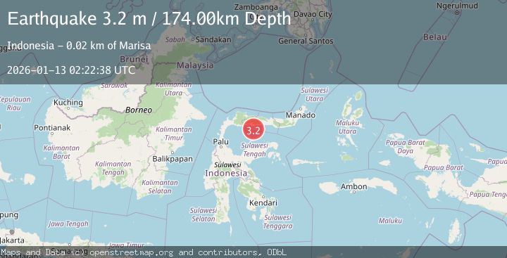
A 3.2 magnitude earthquake struck on MINAHASA, SULAWESI, INDONESIA, at Tue, 13 Jan 2026 02:22:38 GMT. Depth: 174km. Reviewed by BMKG seismologists, this minor quake occurred at a magnitude type of m.
Magnitude
3.2
m
Source
BMKG
Intensity
-
Agency Reports
1 Sources| Source | Magnitude | Depth | Time |
|---|---|---|---|
| BMKGPrimary | 3.2 | 174 km | 1 month ago |
Earthquake Details
AutomaticEvent IDemsc_BMKG_20260113_0000036
Tsunami PotentialNo
Magnitude Typem
Nearest Places
- Lito Lolahe17.4 km
- Sungai Paguat19.8 km
- Wulungiyo Olihidu20.1 km
- Dutula Randangan20.1 km
- Tanjung Bilalahuntu20.3 km
Comments
Join the discussion about this event.
Latest Earthquakes
0.6Mag
12 km SE of Anza, CA
Time9 minutes ago
Depth6.49 km
SourceUSGS (Automatic)
2.6Mag
western Texas
Time11 minutes ago
Depth12.70 km
SourceVYT (Automatic)
2.0Mag
Sumbawa Region, Indonesia
Time12 minutes ago
Depth21.49 km
SourceBMKG
1.0Mag
Southern Alaska
Time12 minutes ago
Depth1.34 km
SourceVYT (Automatic)
1.7Mag
Dead Sea region
Time14 minutes ago
Depth0.00 km
SourceVYT (Automatic)
Nearby Earthquakes
3.0Mag
MINAHASA, SULAWESI, INDONESIA
Time10 months ago
Depth142.00 km
SourceBMKG (Automatic)
3.1Mag
MINAHASA, SULAWESI, INDONESIA
Time1 month ago
Depth174.00 km
SourceBMKG (Automatic)
3.0Mag
MINAHASA, SULAWESI, INDONESIA
Time3 years ago
Depth171.00 km
SourceDJA (Automatic)
5.1Mag
MINAHASA, SULAWESI, INDONESIA
Time15 years ago
Depth200.00 km
SourceEMSC (Automatic)
2.8Mag
MINAHASA, SULAWESI, INDONESIA
Time1 month ago
Depth186.00 km
SourceBMKG (Automatic)