Earthquake KEP. TANIMBAR REGION, INDONESIA
Tue, 13 Jan 2026 02:54:02 GMT
Time1 month ago
Location
-6.7800, 131.8800
Depth
76.0 KM
Event Summary
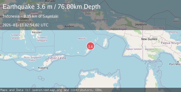
A 3.6 magnitude earthquake struck on KEP. TANIMBAR REGION, INDONESIA, at Tue, 13 Jan 2026 02:54:02 GMT. Depth: 76km. Reviewed by BMKG seismologists, this minor quake occurred at a magnitude type of m.
Magnitude
3.6
m
Source
BMKG
Intensity
-
Agency Reports
1 Sources| Source | Magnitude | Depth | Time |
|---|---|---|---|
| BMKGPrimary | 3.6 | 76 km | 1 month ago |
Earthquake Details
AutomaticEvent IDemsc_BMKG_20260113_0000045
Tsunami PotentialNo
Magnitude Typem
Nearest Places
- Watsira26.6 km
- Adodu26.7 km
- Desa Adodo Fordata27.0 km
- Tanjung Waarlangier27.0 km
- Walera27.5 km
Comments
Join the discussion about this event.
Latest Earthquakes
3.6Mag
Fox Islands, Aleutian Islands, Alaska
Time2 minutes ago
Depth28.81 km
SourceVYT (Automatic)
1.3Mag
Washington
Time3 minutes ago
Depth0.00 km
SourceVYT (Automatic)
2.0Mag
Antofagasta, Chile
Time5 minutes ago
Depth28.32 km
SourceVYT (Automatic)
1.2Mag
Central Alaska
Time5 minutes ago
Depth0.00 km
SourceVYT (Automatic)
2.1Mag
Sulawesi, Indonesia
Time6 minutes ago
Depth7.10 km
SourceBMKG
Nearby Earthquakes
5.0Mag
KEP. TANIMBAR REGION, INDONESIA
Time12 years ago
Depth45.00 km
SourceEMSC (Automatic)
5.3Mag
KEP. TANIMBAR REGION, INDONESIA
Time19 years ago
Depth2.00 km
SourceEMSC (Automatic)
5.5Mag
KEP. TANIMBAR REGION, INDONESIA
Time6 years ago
Depth48.00 km
SourceEMSC (Automatic)
5.0Mag
KEP. TANIMBAR REGION, INDONESIA
Time16 years ago
Depth40.00 km
SourceEMSC (Automatic)
5.0Mag
KEP. TANIMBAR REGION, INDONESIA
Time6 years ago
Depth10.00 km
SourceEMSC (Automatic)