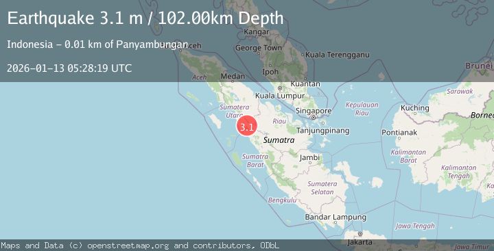
Earthquake NORTHERN SUMATRA, INDONESIA
Tue, 13 Jan 2026 05:28:19 GMT
Time1 month ago
Location
0.7500, 99.6100
Depth
102.0 KM
Event Summary
A 3.1 magnitude earthquake struck on NORTHERN SUMATRA, INDONESIA, at Tue, 13 Jan 2026 05:28:19 GMT. Depth: 102km. Reviewed by BMKG seismologists, this minor quake occurred at a magnitude type of m.
Magnitude
3.1
m
Source
BMKG
Intensity
-
Agency Reports
1 Sources| Source | Magnitude | Depth | Time |
|---|---|---|---|
| BMKGPrimary | 3.1 | 102 km | 1 month ago |
Earthquake Details
AutomaticEvent IDemsc_BMKG_20260113_0000085
Tsunami PotentialNo
Magnitude Typem
Nearest Places
- 1.0 km
- 1.4 km
- 1.4 km
- 1.8 km
- 1.9 km
Comments
Join the discussion about this event.
Latest Earthquakes
3.5Mag
AEGEAN SEA
Time8 minutes ago
Depth5.00 km
SourceNOA (Automatic)
2.7Mag
Fox Islands, Aleutian Islands, Alaska
Time11 minutes ago
Depth0.00 km
SourceVYT (Automatic)
2.4Mag
Alaska Peninsula
Time12 minutes ago
Depth27.34 km
SourceVYT (Automatic)
3.2Mag
Fox Islands, Aleutian Islands, Alaska
Time13 minutes ago
Depth19.17 km
SourceVYT (Automatic)
2.2Mag
51 km N of Petersville, Alaska
Time14 minutes ago
Depth89.30 km
SourceUSGS (Automatic)
Nearby Earthquakes
3.0Mag
NORTHERN SUMATRA, INDONESIA
Time3 years ago
Depth10.00 km
SourceDJA (Automatic)
3.2Mag
Northern Sumatra, Indonesia
Time3 weeks ago
Depth4.64 km
SourceBMKG (Automatic)
3.0Mag
NORTHERN SUMATRA, INDONESIA
Time10 months ago
Depth10.00 km
SourceBMKG (Automatic)
3.0Mag
NORTHERN SUMATRA, INDONESIA
Time2 years ago
Depth83.00 km
SourceBMKG (Automatic)
5.8Mag
NORTHERN SUMATRA, INDONESIA
Time19 years ago
Depth10.00 km
SourceEMSC (Automatic)