Earthquake NEAR N COAST OF PAPUA, INDONESIA
Mon, 19 Jan 2026 16:44:03 GMT
Time1 month ago
Location
-2.0400, 139.2200
Depth
37.0 KM
Event Summary
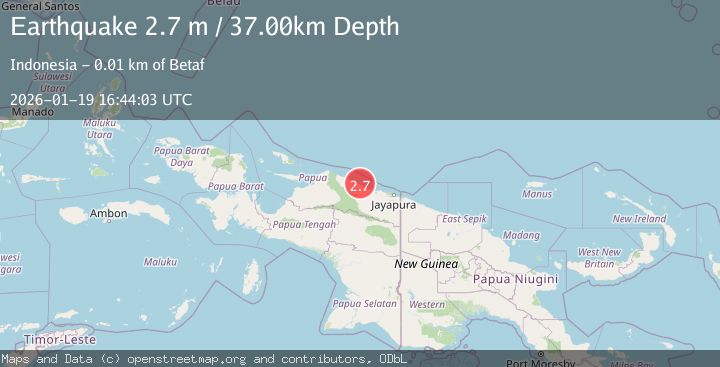
A 2.7 magnitude earthquake struck on NEAR N COAST OF PAPUA, INDONESIA, at Mon, 19 Jan 2026 16:44:03 GMT. Depth: 37km. Reviewed by BMKG seismologists, this minor quake occurred at a magnitude type of m.
Magnitude
2.7
m
Source
BMKG
Intensity
-
Agency Reports
1 Sources| Source | Magnitude | Depth | Time |
|---|---|---|---|
| BMKGPrimary | 2.7 | 37 km | 1 month ago |
Earthquake Details
AutomaticEvent IDemsc_BMKG_20260119_0000219
Tsunami PotentialNo
Magnitude Typem
Nearest Places
- Pulau Mademo3.6 km
- Sosakar5.0 km
- Jamna5.6 km
- Beneraf5.8 km
- Sungai Oranie6.1 km
Comments
Join the discussion about this event.
Latest Earthquakes
1.6Mag
Southern Alaska
Time5 minutes ago
Depth48.58 km
SourceVYT (Automatic)
2.3Mag
Antofagasta, Chile
Time7 minutes ago
Depth82.15 km
SourceVYT (Automatic)
2.1Mag
Southern Alaska
Time10 minutes ago
Depth64.21 km
SourceVYT (Automatic)
2.5Mag
Central Alaska
Time15 minutes ago
Depth312.99 km
SourceVYT (Automatic)
3.6Mag
Banda Sea
Time22 minutes ago
Depth0.00 km
SourceVYT (Automatic)
Nearby Earthquakes
3.0Mag
NEAR N COAST OF PAPUA, INDONESIA
Time3 years ago
Depth27.00 km
SourceDJA (Automatic)
3.0Mag
NEAR N COAST OF PAPUA, INDONESIA
Time1 month ago
Depth49.00 km
SourceBMKG (Automatic)
3.0Mag
NEAR N COAST OF PAPUA, INDONESIA
Time4 months ago
Depth10.00 km
SourceBMKG (Automatic)
5.1Mag
NEAR N COAST OF PAPUA, INDONESIA
Time8 years ago
Depth40.00 km
SourceEMSC (Automatic)
4.0Mag
NEAR N COAST OF PAPUA, INDONESIA
Time4 months ago
Depth12.00 km
SourceBMKG (Automatic)