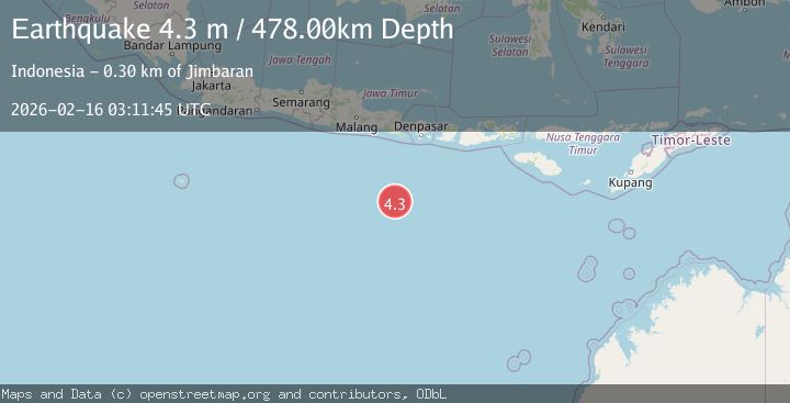
Earthquake SOUTH OF BALI, INDONESIA
Mon, 16 Feb 2026 03:11:45 GMT
Time1 month ago
Location
-11.2900, 114.1700
Depth
478.0 KM
Event Summary
A 4.3 magnitude earthquake struck on SOUTH OF BALI, INDONESIA, at Mon, 16 Feb 2026 03:11:45 GMT. Depth: 478km. Reviewed by BMKG seismologists, this light quake occurred at a magnitude type of m.
Magnitude
4.3
m
Source
BMKG
Intensity
-
Agency Reports
1 Sources| Source | Magnitude | Depth | Time |
|---|---|---|---|
| BMKGPrimary | 4.3 | 478 km | 1 month ago |
Earthquake Details
AutomaticEvent IDemsc_BMKG_20260216_0000168
QualityS
Tsunami PotentialNo
Magnitude Typem
Last Update1 month ago
Felt Reports0
Did you feel this earthquake? Report it to help others.
No reports yet
Be the first to report this earthquake!
Latest Earthquakes
Loading...
Nearby Earthquakes
3.8Mag
South of Java, Indonesia
Time1 week ago
Depth10.00 km
SourceBMKG
3.2Mag
South of Java, Indonesia
Time1 week ago
Depth10.00 km
SourceBMKG
4.8Mag
south of Java, Indonesia
Time1 week ago
Depth10.00 km
SourceVYT
3.8Mag
South of Java, Indonesia
Time1 week ago
Depth243.70 km
SourceBMKG
3.6Mag
SOUTH OF JAVA, INDONESIA
Time1 week ago
Depth10.00 km
SourceBMKG (Automatic)