Earthquake MOLUCCA SEA
Mon, 18 Feb 2019 20:45:27 GMT
Time7 years ago
Location
0.9900, 126.1500
Depth
11.0 KM
Event Summary
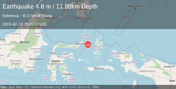
A 4.0 magnitude earthquake struck on MOLUCCA SEA, at Mon, 18 Feb 2019 20:45:27 GMT. Depth: 11km. Reviewed by DJA seismologists, this light quake occurred at a magnitude type of m.
Magnitude
4.0
m
Source
DJA
Intensity
-
Agency Reports
1 Sources| Source | Magnitude | Depth | Time |
|---|---|---|---|
| DJAPrimary | 4.0 | 11 km | 7 years ago |
Earthquake Details
AutomaticEvent IDemsc_DJA_20190218_0000105
Tsunami PotentialNo
Magnitude Typem
Nearest Places
- Pulau Gureda0.4 km
- Pulau Tifore2.1 km
- Kelurahan Pantai Sagu2.1 km
- Kelurahan Tifure2.5 km
- Tanjung Geranomaderi40.2 km
Comments
Join the discussion about this event.
Latest Earthquakes
0.7Mag
Northern Territory, Australia
Time21 minutes ago
Depth74.10 km
SourceVYT (Automatic)
3.1Mag
Halmahera, Indonesia
Time28 minutes ago
Depth113.40 km
SourceVYT (Automatic)
1.3Mag
WESTERN TURKEY
Time29 minutes ago
Depth15.10 km
SourceAFAD (Automatic)
1.0Mag
6 km WNW of Cobb, CA
Time29 minutes ago
Depth1.71 km
SourceUSGS (Automatic)
1.5Mag
Southern Alaska
Time29 minutes ago
Depth19.90 km
SourceVYT (Automatic)
Nearby Earthquakes
5.0Mag
MOLUCCA SEA
Time7 years ago
Depth10.00 km
SourceEMSC (Automatic)
5.3Mag
MOLUCCA SEA
Time9 years ago
Depth60.00 km
SourceEMSC (Automatic)
5.4Mag
MOLUCCA SEA
Time7 years ago
Depth60.00 km
SourceEMSC (Automatic)
5.3Mag
MOLUCCA SEA
Time3 years ago
Depth30.00 km
SourceEMSC (Automatic)
4.0Mag
MOLUCCA SEA
Time1 year ago
Depth38.00 km
SourceBMKG (Automatic)