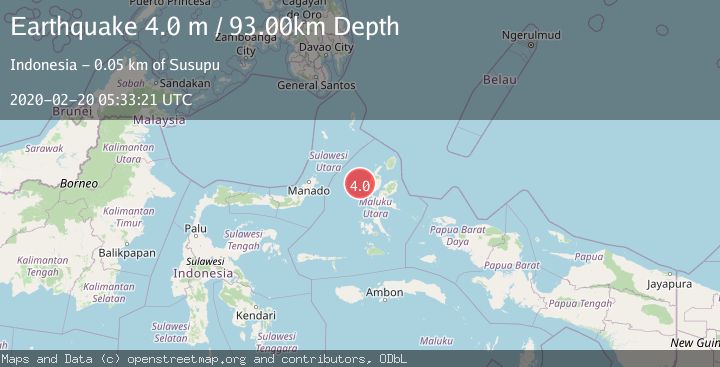
Earthquake HALMAHERA, INDONESIA
Thu, 20 Feb 2020 05:33:21 GMT
Time6 years ago
Location
1.4400, 127.1300
Depth
93.0 KM
Event Summary
A 4.0 magnitude earthquake struck on HALMAHERA, INDONESIA, at Thu, 20 Feb 2020 05:33:21 GMT. Depth: 93km. Reviewed by DJA seismologists, this light quake occurred at a magnitude type of m.
Magnitude
4.0
m
Source
DJA
Intensity
-
Agency Reports
1 Sources| Source | Magnitude | Depth | Time |
|---|---|---|---|
| DJAPrimary | 4.0 | 93 km | 6 years ago |
Earthquake Details
AutomaticEvent IDemsc_DJA_20200220_0000094
Tsunami PotentialNo
Magnitude Typem
Nearest Places
- Nyi10.0 km
- Tanjung Hafo38.1 km
- Tanjung Tuasaselo38.3 km
- Gorogoro38.3 km
- Tanjung Tabobo38.4 km
Comments
Join the discussion about this event.
Latest Earthquakes
1.7Mag
northern Alaska
Time5 minutes ago
Depth4.64 km
SourceVYT (Automatic)
1.2Mag
5 km WNW of The Geysers, CA
Time10 minutes ago
Depth3.19 km
SourceUSGS (Automatic)
3.4Mag
Sulawesi, Indonesia
Time14 minutes ago
Depth27.95 km
SourceVYT (Automatic)
1.6Mag
Central Alaska
Time15 minutes ago
Depth18.07 km
SourceVYT (Automatic)
2.5Mag
Bering Strait
Time22 minutes ago
Depth200.07 km
SourceVYT (Automatic)
Nearby Earthquakes
2.7Mag
HALMAHERA, INDONESIA
Time1 month ago
Depth10.00 km
SourceBMKG (Automatic)
3.1Mag
Halmahera, Indonesia
Time3 weeks ago
Depth10.16 km
SourceBMKG (Automatic)
5.0Mag
HALMAHERA, INDONESIA
Time13 years ago
Depth74.00 km
SourceEMSC (Automatic)
5.0Mag
HALMAHERA, INDONESIA
Time7 years ago
Depth93.00 km
SourceEMSC (Automatic)
5.0Mag
HALMAHERA, INDONESIA
Time4 years ago
Depth128.00 km
SourceEMSC (Automatic)