Earthquake SOUTHERN SUMATRA, INDONESIA
Sat, 17 Jul 2021 20:34:15 GMT
Time4 years ago
Location
-3.0900, 101.1700
Depth
18.0 KM
Event Summary
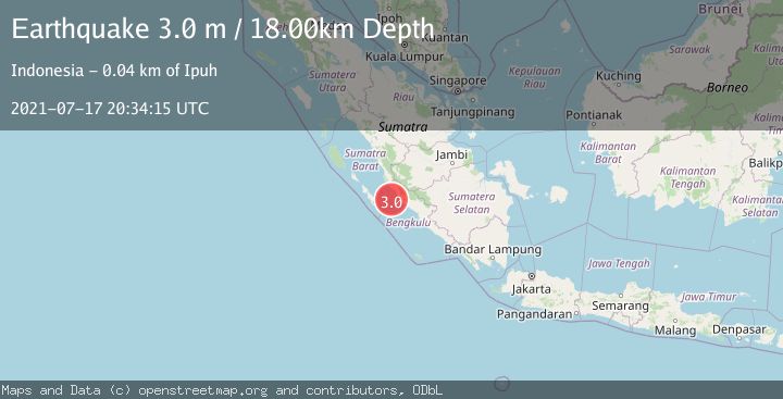
A 3.0 magnitude earthquake struck on SOUTHERN SUMATRA, INDONESIA, at Sat, 17 Jul 2021 20:34:15 GMT. Depth: 18km. Reviewed by DJA seismologists, this minor quake occurred at a magnitude type of m.
Magnitude
3.0
m
Source
DJA
Intensity
-
Agency Reports
1 Sources| Source | Magnitude | Depth | Time |
|---|---|---|---|
| DJAPrimary | 3.0 | 18 km | 4 years ago |
Earthquake Details
AutomaticEvent IDemsc_DJA_20210717_0000207
Tsunami PotentialNo
Magnitude Typem
Nearest Places
- Air Hitam32.2 km
- Sungai Merusu32.3 km
- Air Retak32.6 km
- Retakhilir33.3 km
- Desa Sinar Laut33.3 km
Comments
Join the discussion about this event.
Latest Earthquakes
2.0Mag
northwestern Russia
Time6 minutes ago
Depth0.00 km
SourceVYT (Automatic)
4.7Mag
Molucca Sea
Time8 minutes ago
Depth0.00 km
SourceVYT (Automatic)
1.3Mag
Central Alaska
Time13 minutes ago
Depth10.00 km
SourceVYT (Automatic)
2.2Mag
FRANCE
Time15 minutes ago
Depth5.00 km
SourceReNaSS (Automatic)
2.3Mag
Minahassa Peninsula, Sulawesi
Time15 minutes ago
Depth10.00 km
SourceBMKG
Nearby Earthquakes
3.9Mag
SOUTHERN SUMATRA, INDONESIA
Time1 month ago
Depth21.00 km
SourceBMKG (Automatic)
3.0Mag
SOUTHERN SUMATRA, INDONESIA
Time1 month ago
Depth21.00 km
SourceBMKG (Automatic)
5.0Mag
SOUTHERN SUMATRA, INDONESIA
Time15 years ago
Depth60.00 km
SourceEMSC (Automatic)
3.6Mag
Southern Sumatra, Indonesia
Time3 weeks ago
Depth11.08 km
SourceBMKG (Automatic)
3.0Mag
SOUTHERN SUMATRA, INDONESIA
Time2 months ago
Depth22.00 km
SourceBMKG (Automatic)