Earthquake SOUTH OF KERMADEC ISLANDS
Sun, 13 Feb 2005 15:12:13 GMT
Time21 years ago
Location
-33.5300, -178.5400
Depth
33.0 KM
Event Summary
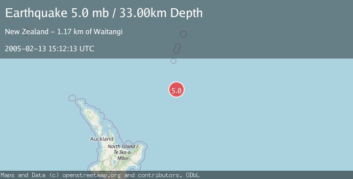
A 5.0 magnitude earthquake struck on SOUTH OF KERMADEC ISLANDS, at Sun, 13 Feb 2005 15:12:13 GMT. Depth: 33km. Reviewed by EMSC seismologists, this moderate quake occurred at a magnitude type of mb.
Magnitude
5.0
mb
Source
EMSC
Intensity
-
Agency Reports
1 Sources| Source | Magnitude | Depth | Time |
|---|---|---|---|
| EMSCPrimary | 5.0 | 33 km | 21 years ago |
Earthquake Details
AutomaticEvent IDemsc_EMSC_20050213_0000040
Tsunami PotentialNo
Magnitude Typemb
Nearest Places
- Star of Bengal Bank134.4 km
- Kuiwai Seamount134.5 km
- Haungaroa Seamount143.6 km
- Ngātoroirangi Seamount155.7 km
- Speight Knoll160.4 km
Comments
Join the discussion about this event.
Latest Earthquakes
3.8Mag
Kenai Peninsula, Alaska
Time4 minutes ago
Depth49.93 km
SourceVYT (Automatic)
5.7Mag
HINDU KUSH REGION, AFGHANISTAN
Time8 minutes ago
Depth72.80 km
SourceGFZ (Automatic)
3.0Mag
WESTERN HONSHU, JAPAN
Time10 minutes ago
Depth10.00 km
SourceJMA (Automatic)
2.3Mag
Sulawesi, Indonesia
Time13 minutes ago
Depth1.90 km
SourceBMKG
1.8Mag
western Texas
Time15 minutes ago
Depth0.12 km
SourceVYT (Automatic)
Nearby Earthquakes
5.2Mag
SOUTH OF KERMADEC ISLANDS
Time4 months ago
Depth15.20 km
SourceNEIC (Automatic)
5.0Mag
SOUTH OF KERMADEC ISLANDS
Time6 years ago
Depth40.00 km
SourceEMSC (Automatic)
5.0Mag
SOUTH OF KERMADEC ISLANDS
Time9 years ago
Depth10.00 km
SourceEMSC (Automatic)
5.8Mag
SOUTH OF KERMADEC ISLANDS
Time1 year ago
Depth10.00 km
SourceEMSC (Automatic)
5.2Mag
SOUTH OF KERMADEC ISLANDS
Time15 years ago
Depth2.00 km
SourceEMSC (Automatic)