Earthquake MINDANAO, PHILIPPINES
Mon, 12 Feb 2007 12:45:31 GMT
Time19 years ago
Location
5.6000, 126.4300
Depth
40.0 KM
Event Summary
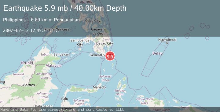
A 5.9 magnitude earthquake struck on MINDANAO, PHILIPPINES, at Mon, 12 Feb 2007 12:45:31 GMT. Depth: 40km. Reviewed by EMSC seismologists, this moderate quake occurred at a magnitude type of mb.
Magnitude
5.9
mb
Source
EMSC
Intensity
-
Agency Reports
1 Sources| Source | Magnitude | Depth | Time |
|---|---|---|---|
| EMSCPrimary | 5.9 | 40 km | 19 years ago |
Earthquake Details
AutomaticEvent IDemsc_EMSC_20070212_0000049
Tsunami PotentialNo
Magnitude Typemb
Nearest Places
- Miangas17.4 km
- Pulau Miangas17.6 km
- Kecamatan Miangas17.6 km
- Desa Pulau Miangas17.7 km
- Pulau Baronto17.9 km
Comments
Join the discussion about this event.
Latest Earthquakes
2.5Mag
Tarapaca, Chile
Time4 minutes ago
Depth112.55 km
SourceVYT (Automatic)
2.2Mag
Tarapaca, Chile
Time10 minutes ago
Depth111.94 km
SourceVYT (Automatic)
1.9Mag
Central Alaska
Time11 minutes ago
Depth32.10 km
SourceVYT (Automatic)
3.4Mag
HAWAII REGION, HAWAII
Time11 minutes ago
Depth4.70 km
SourceHV (Automatic)
1.9Mag
STRAIT OF GIBRALTAR
Time14 minutes ago
Depth0.00 km
SourceIGN (Automatic)
Nearby Earthquakes
3.8Mag
MINDANAO, PHILIPPINES
Time1 month ago
Depth10.00 km
SourceBMKG (Automatic)
3.0Mag
MINDANAO, PHILIPPINES
Time1 year ago
Depth25.00 km
SourcePIVS (Automatic)
3.0Mag
MINDANAO, PHILIPPINES
Time4 years ago
Depth54.00 km
SourcePIVS (Automatic)
3.0Mag
MINDANAO, PHILIPPINES
Time1 year ago
Depth36.00 km
SourcePIVS (Automatic)
5.5Mag
MINDANAO, PHILIPPINES
Time19 years ago
Depth60.00 km
SourceEMSC (Automatic)