Earthquake NORTHERN SUMATRA, INDONESIA
Wed, 14 Feb 2007 20:11:57 GMT
Time19 years ago
Location
5.3000, 94.3300
Depth
40.0 KM
Event Summary
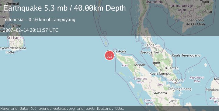
A 5.3 magnitude earthquake struck on NORTHERN SUMATRA, INDONESIA, at Wed, 14 Feb 2007 20:11:57 GMT. Depth: 40km. Reviewed by EMSC seismologists, this moderate quake occurred at a magnitude type of mb.
Magnitude
5.3
mb
Source
EMSC
Intensity
-
Agency Reports
1 Sources| Source | Magnitude | Depth | Time |
|---|---|---|---|
| EMSCPrimary | 5.3 | 40 km | 19 years ago |
Earthquake Details
AutomaticEvent IDemsc_EMSC_20070214_0000069
Tsunami PotentialNo
Magnitude Typemb
Nearest Places
- Nicobar-Simeulue Basin38.3 km
- Karang Sindoro80.7 km
- Great Channel86.0 km
- Ujung Kerumbu87.6 km
- Terumbu Sarang87.9 km
Comments
Join the discussion about this event.
Latest Earthquakes
2.1Mag
WESTERN TEXAS
Time43 minutes ago
Depth6.60 km
SourceTX (Automatic)
2.7Mag
southern Sumatra, Indonesia
Time46 minutes ago
Depth7.08 km
SourceVYT (Automatic)
0.9Mag
Washington
Time46 minutes ago
Depth0.98 km
SourceVYT (Automatic)
2.5Mag
Tarapaca, Chile
Time49 minutes ago
Depth0.00 km
SourceVYT (Automatic)
1.1Mag
WESTERN TURKEY
Time49 minutes ago
Depth4.00 km
SourceAFAD (Automatic)
Nearby Earthquakes
5.2Mag
NORTHERN SUMATRA, INDONESIA
Time16 years ago
Depth41.00 km
SourceEMSC (Automatic)
5.1Mag
NORTHERN SUMATRA, INDONESIA
Time16 years ago
Depth40.00 km
SourceEMSC (Automatic)
5.0Mag
NORTHERN SUMATRA, INDONESIA
Time4 years ago
Depth48.00 km
SourceEMSC (Automatic)
5.1Mag
NORTHERN SUMATRA, INDONESIA
Time12 years ago
Depth40.00 km
SourceEMSC (Automatic)
3.0Mag
NORTHERN SUMATRA, INDONESIA
Time5 months ago
Depth10.00 km
SourceBMKG (Automatic)