Earthquake SOUTH OF KERMADEC ISLANDS
Thu, 15 Feb 2007 10:27:28 GMT
Time19 years ago
Location
-32.2400, -177.5300
Depth
33.0 KM
Event Summary
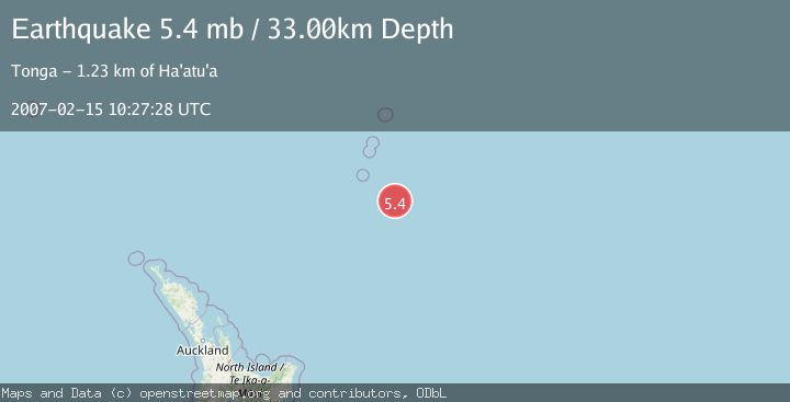
A 5.4 magnitude earthquake struck on SOUTH OF KERMADEC ISLANDS, at Thu, 15 Feb 2007 10:27:28 GMT. Depth: 33km. Reviewed by EMSC seismologists, this moderate quake occurred at a magnitude type of mb.
Magnitude
5.4
mb
Source
EMSC
Intensity
-
Agency Reports
1 Sources| Source | Magnitude | Depth | Time |
|---|---|---|---|
| EMSCPrimary | 5.4 | 33 km | 19 years ago |
Earthquake Details
AutomaticEvent IDemsc_EMSC_20070215_0000037
Tsunami PotentialNo
Magnitude Typemb
Nearest Places
- 34.4 km
- 76.7 km
- 128.3 km
- 135.1 km
- 135.4 km
Comments
Join the discussion about this event.
Latest Earthquakes
3.4Mag
Tarapaca, Chile
Time4 hours ago
Depth94.36 km
SourceVYT (Automatic)
2.0Mag
Washington
Time4 hours ago
Depth20.39 km
SourceVYT (Automatic)
2.4Mag
ISLAND OF HAWAII, HAWAII
Time4 hours ago
Depth33.70 km
SourceHV (Automatic)
3.5Mag
SIKKIM, INDIA
Time4 hours ago
Depth6.70 km
SourceNDI (Automatic)
2.5Mag
South of Java, Indonesia
Time4 hours ago
Depth162.67 km
SourceBMKG
Nearby Earthquakes
5.1Mag
SOUTH OF KERMADEC ISLANDS
Time6 years ago
Depth10.00 km
SourceEMSC (Automatic)
5.9Mag
SOUTH OF KERMADEC ISLANDS
Time6 years ago
Depth10.00 km
SourceEMSC (Automatic)
5.2Mag
SOUTH OF KERMADEC ISLANDS
Time3 years ago
Depth2.00 km
SourceEMSC (Automatic)
5.0Mag
SOUTH OF KERMADEC ISLANDS
Time12 years ago
Depth9.00 km
SourceNEIC (Automatic)
5.2Mag
SOUTH OF KERMADEC ISLANDS
Time10 years ago
Depth10.00 km
SourceEMSC (Automatic)