Earthquake SOUTHERN SUMATRA, INDONESIA
Tue, 27 Nov 2007 15:46:12 GMT
Time18 years ago
Location
-1.5500, 100.4700
Depth
60.0 KM
Event Summary
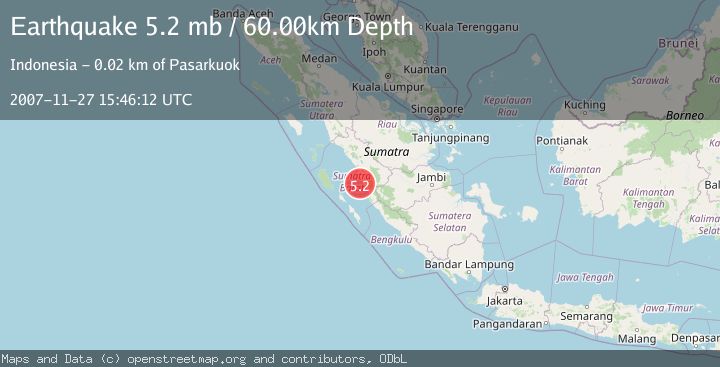
A 5.2 magnitude earthquake struck on SOUTHERN SUMATRA, INDONESIA, at Tue, 27 Nov 2007 15:46:12 GMT. Depth: 60km. Reviewed by EMSC seismologists, this moderate quake occurred at a magnitude type of mb.
Magnitude
5.2
mb
Source
EMSC
Intensity
-
Agency Reports
1 Sources| Source | Magnitude | Depth | Time |
|---|---|---|---|
| EMSCPrimary | 5.2 | 60 km | 18 years ago |
Earthquake Details
AutomaticEvent IDemsc_EMSC_20071127_0000067
Tsunami PotentialNo
Magnitude Typemb
Nearest Places
- Pulau Panyu6.0 km
- Pulau Karaba Kecil6.8 km
- Pulau Karaba Besar13.0 km
- Air Tartaktumpatih15.3 km
- Mandiangin15.7 km
Comments
Join the discussion about this event.
Latest Earthquakes
2.6Mag
Sulawesi, Indonesia
Time16 hours ago
Depth10.00 km
SourceBMKG
1.1Mag
British Columbia, Canada
Time17 hours ago
Depth16.24 km
SourceVYT (Automatic)
3.4Mag
NEAR COAST OF NICARAGUA
Time17 hours ago
Depth36.00 km
SourceINET (Automatic)
2.2Mag
DODECANESE IS.-TURKEY BORDER REG
Time17 hours ago
Depth5.00 km
SourceKOERI (Automatic)
2.7Mag
South Australia
Time17 hours ago
Depth264.28 km
SourceVYT (Automatic)
Nearby Earthquakes
3.0Mag
SOUTHERN SUMATRA, INDONESIA
Time9 months ago
Depth46.00 km
SourceBMKG (Automatic)
5.5Mag
SOUTHERN SUMATRA, INDONESIA
Time9 years ago
Depth73.00 km
SourceEMSC (Automatic)
5.5Mag
SOUTHERN SUMATRA, INDONESIA
Time18 years ago
Depth40.00 km
SourceEMSC (Automatic)
3.0Mag
SOUTHERN SUMATRA, INDONESIA
Time4 years ago
Depth10.00 km
SourceDJA (Automatic)
2.6Mag
SOUTHERN SUMATRA, INDONESIA
Time1 month ago
Depth48.00 km
SourceBMKG (Automatic)