Earthquake STRAIT OF GIBRALTAR
Sat, 16 Feb 2008 01:42:20 GMT
Time18 years ago
Location
35.2303, -5.9094
Depth
10.0 KM
Event Summary
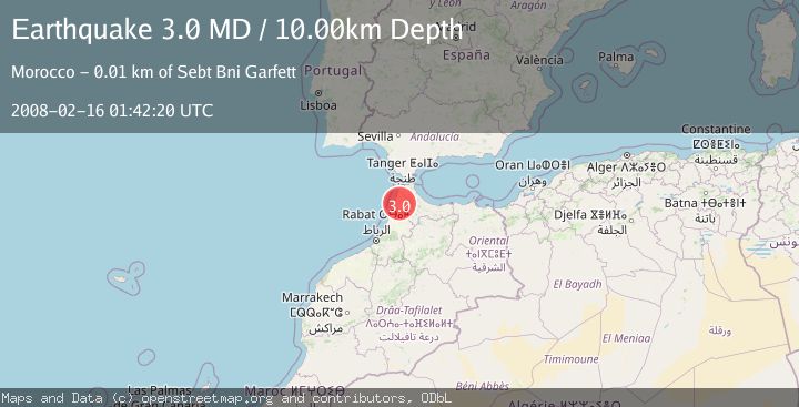
A 3.0 magnitude earthquake struck on STRAIT OF GIBRALTAR, at Sat, 16 Feb 2008 01:42:20 GMT. Depth: 10km. Reviewed by EMSC seismologists, this minor quake occurred at a magnitude type of MD.
Magnitude
3.0
MD
Source
EMSC
Intensity
-
Agency Reports
1 Sources| Source | Magnitude | Depth | Time |
|---|---|---|---|
| EMSCPrimary | 3.0 | 10 km | 18 years ago |
Earthquake Details
AutomaticEvent IDemsc_EMSC_20080216_0000038
Tsunami PotentialNo
Magnitude TypeMD
Nearest Places
- Khandeq Hortane1.5 km
- Arbaoua Hamri1.5 km
- Oued Mguerouene1.7 km
- Siar Tarkount1.7 km
- Oulad Soultane Tarkount2.4 km
Comments
Join the discussion about this event.
Latest Earthquakes
2.9Mag
Halmahera, Indonesia
Time7 hours ago
Depth20.39 km
SourceVYT (Automatic)
1.9Mag
Central Alaska
Time7 hours ago
Depth87.40 km
SourceVYT (Automatic)
0.4Mag
6 km NNW of The Geysers, CA
Time7 hours ago
Depth1.69 km
SourceUSGS (Automatic)
2.0Mag
Arizona
Time7 hours ago
Depth12.94 km
SourceVYT (Automatic)
2.5Mag
Antofagasta, Chile
Time7 hours ago
Depth0.24 km
SourceVYT (Automatic)
Nearby Earthquakes
3.0Mag
STRAIT OF GIBRALTAR
Time19 years ago
Depth49.10 km
SourceEMSC (Automatic)
3.0Mag
STRAIT OF GIBRALTAR
Time8 years ago
Depth30.00 km
SourceEMSC (Automatic)
3.0Mag
STRAIT OF GIBRALTAR
Time4 months ago
Depth53.60 km
SourceEMSC (Automatic)
3.0Mag
STRAIT OF GIBRALTAR
Time9 months ago
Depth67.00 km
SourceEMSC (Automatic)
3.0Mag
STRAIT OF GIBRALTAR
Time16 years ago
Depth40.00 km
SourceEMSC (Automatic)