Earthquake MINDANAO, PHILIPPINES
Tue, 26 Feb 2008 17:13:36 GMT
Time17 years ago
Location
8.4100, 126.5700
Depth
80.0 KM
Event Summary
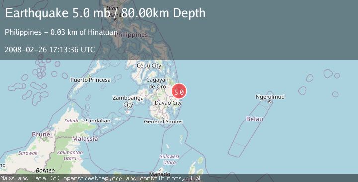
A 5.0 magnitude earthquake struck on MINDANAO, PHILIPPINES, at Tue, 26 Feb 2008 17:13:36 GMT. Depth: 80km. Reviewed by EMSC seismologists, this moderate quake occurred at a magnitude type of mb.
Magnitude
5.0
mb
Source
EMSC
Intensity
-
Agency Reports
1 Sources| Source | Magnitude | Depth | Time |
|---|---|---|---|
| EMSCPrimary | 5.0 | 80 km | 17 years ago |
Earthquake Details
AutomaticEvent IDemsc_EMSC_20080226_0000081
Tsunami PotentialNo
Magnitude Typemb
Nearest Places
- Tigdos Island17.9 km
- Mancahorom Island19.1 km
- Mahaba Island19.6 km
- Lamon Point20.1 km
- Bagasin Island20.5 km
Comments
Join the discussion about this event.
Latest Earthquakes
1.4Mag
8 km N of Rancho Cucamonga, CA
Time5 minutes ago
Depth3.48 km
SourceUSGS (Automatic)
1.3Mag
17 km WSW of Johannesburg, CA
Time8 minutes ago
Depth9.21 km
SourceUSGS (Automatic)
2.0Mag
Flores Region, Indonesia
Time12 minutes ago
Depth27.22 km
SourceBMKG
1.4Mag
31 km WSW of Ackerly, Texas
Time14 minutes ago
Depth9.49 km
SourceUSGS (Automatic)
2.0Mag
Poland
Time17 minutes ago
Depth0.00 km
SourceVYT (Automatic)
Nearby Earthquakes
3.0Mag
MINDANAO, PHILIPPINES
Time2 years ago
Depth16.00 km
SourcePIVS (Automatic)
5.2Mag
MINDANAO, PHILIPPINES
Time2 years ago
Depth63.00 km
SourceEMSC (Automatic)
4.0Mag
MINDANAO, PHILIPPINES
Time1 year ago
Depth16.00 km
SourcePIVS (Automatic)
3.0Mag
MINDANAO, PHILIPPINES
Time1 year ago
Depth33.00 km
SourcePIVS (Automatic)
3.0Mag
MINDANAO, PHILIPPINES
Time1 year ago
Depth24.00 km
SourcePIVS (Automatic)