Earthquake SOUTH OF KERMADEC ISLANDS
Fri, 28 Mar 2008 06:39:44 GMT
Time17 years ago
Location
-32.6500, 179.4000
Depth
325.0 KM
Event Summary
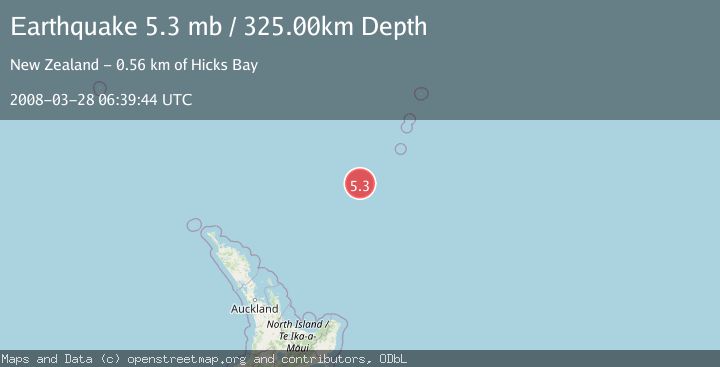
A 5.3 magnitude earthquake struck on SOUTH OF KERMADEC ISLANDS, at Fri, 28 Mar 2008 06:39:44 GMT. Depth: 325km. Reviewed by EMSC seismologists, this moderate quake occurred at a magnitude type of mb.
Magnitude
5.3
mb
Source
EMSC
Intensity
-
Agency Reports
1 Sources| Source | Magnitude | Depth | Time |
|---|---|---|---|
| EMSCPrimary | 5.3 | 325 km | 17 years ago |
Earthquake Details
AutomaticEvent IDemsc_EMSC_20080328_0000045
Tsunami PotentialNo
Magnitude Typemb
Nearest Places
- Kuiwai Seamount85.4 km
- Haungaroa Seamount90.5 km
- Oliver Knoll91.5 km
- Speight Knoll99.2 km
- Ngātoroirangi Seamount126.2 km
Comments
Join the discussion about this event.
Latest Earthquakes
2.2Mag
Sulawesi, Indonesia
Time9 minutes ago
Depth17.09 km
SourceBMKG
3.2Mag
Southeastern Alaska
Time12 minutes ago
Depth0.00 km
SourceVYT (Automatic)
0.8Mag
6 km WNW of Cobb, CA
Time14 minutes ago
Depth1.91 km
SourceUSGS (Automatic)
2.9Mag
STRAIT OF GIBRALTAR
Time15 minutes ago
Depth5.00 km
SourceIGN (Automatic)
0.9Mag
7 km NW of The Geysers, CA
Time17 minutes ago
Depth2.49 km
SourceUSGS (Automatic)
Nearby Earthquakes
4.0Mag
SOUTH OF KERMADEC ISLANDS
Time1 year ago
Depth359.10 km
SourceNEIC (Automatic)
4.0Mag
SOUTH OF KERMADEC ISLANDS
Time4 years ago
Depth589.00 km
SourceGNS (Automatic)
4.0Mag
SOUTH OF KERMADEC ISLANDS
Time5 years ago
Depth177.00 km
SourceGNS (Automatic)
4.0Mag
SOUTH OF KERMADEC ISLANDS
Time4 years ago
Depth415.00 km
SourceGNS (Automatic)
3.0Mag
SOUTH OF KERMADEC ISLANDS
Time2 years ago
Depth500.00 km
SourceGNS (Automatic)