Earthquake HALMAHERA, INDONESIA
Thu, 11 Sep 2008 00:00:02 GMT
Time17 years ago
Location
1.9500, 127.4400
Depth
112.0 KM
Event Summary
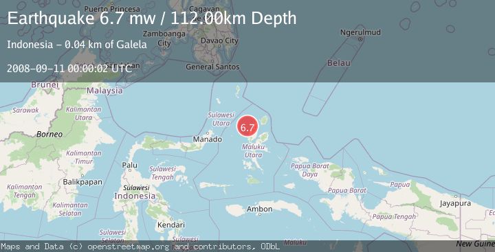
A 6.7 magnitude earthquake struck on HALMAHERA, INDONESIA, at Thu, 11 Sep 2008 00:00:02 GMT. Depth: 112km. Reviewed by EMSC seismologists, this strong quake occurred at a magnitude type of mw.
Magnitude
6.7
mw
Source
EMSC
Intensity
-
Agency Reports
1 Sources| Source | Magnitude | Depth | Time |
|---|---|---|---|
| EMSCPrimary | 6.7 | 112 km | 17 years ago |
Earthquake Details
AutomaticEvent IDemsc_EMSC_20080911_0000052
Tsunami PotentialNo
Magnitude Typemw
Nearest Places
- Pulau Goralamo24.3 km
- Pulau Bulana24.4 km
- Pulau Sogiloga24.6 km
- Pulau Barataku25.3 km
- Tanjung Tomelesumu25.6 km
Comments
Join the discussion about this event.
Latest Earthquakes
3.2Mag
Antofagasta, Chile
Time6 minutes ago
Depth124.27 km
SourceVYT (Automatic)
1.7Mag
Kenai Peninsula, Alaska
Time12 minutes ago
Depth28.44 km
SourceVYT (Automatic)
1.7Mag
Tarapaca, Chile
Time15 minutes ago
Depth6.47 km
SourceVYT (Automatic)
1.9Mag
Central Alaska
Time18 minutes ago
Depth81.18 km
SourceVYT (Automatic)
1.2Mag
21 km ENE of Little Lake, CA
Time19 minutes ago
Depth0.90 km
SourceUSGS (Automatic)
Nearby Earthquakes
5.2Mag
HALMAHERA, INDONESIA
Time15 years ago
Depth104.00 km
SourceEMSC (Automatic)
5.0Mag
HALMAHERA, INDONESIA
Time4 years ago
Depth94.00 km
SourceEMSC (Automatic)
3.2Mag
Halmahera, Indonesia
Time3 weeks ago
Depth114.35 km
SourceBMKG (Automatic)
4.0Mag
HALMAHERA, INDONESIA
Time4 years ago
Depth114.00 km
SourceNEIC (Automatic)
3.4Mag
HALMAHERA, INDONESIA
Time1 month ago
Depth17.00 km
SourceBMKG (Automatic)