Earthquake EAST TIMOR REGION
Tue, 16 Sep 2008 11:15:41 GMT
Time17 years ago
Location
-8.9200, 126.8200
Depth
40.0 KM
Event Summary
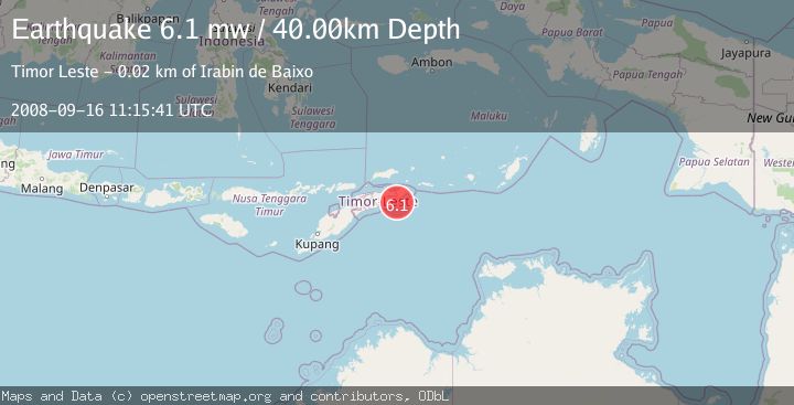
A 6.1 magnitude earthquake struck on EAST TIMOR REGION, at Tue, 16 Sep 2008 11:15:41 GMT. Depth: 40km. Reviewed by EMSC seismologists, this strong quake occurred at a magnitude type of mw.
Magnitude
6.1
mw
Source
EMSC
Intensity
-
Agency Reports
1 Sources| Source | Magnitude | Depth | Time |
|---|---|---|---|
| EMSCPrimary | 6.1 | 40 km | 17 years ago |
Earthquake Details
AutomaticEvent IDemsc_EMSC_20080916_0000060
Tsunami PotentialNo
Magnitude Typemw
Nearest Places
- Tanjung Ima18.4 km
- Sungai Lihulo18.5 km
- Gunung Malomar18.8 km
- Gunung Habatahomo18.9 km
- Rofo18.9 km
Comments
Join the discussion about this event.
Latest Earthquakes
2.1Mag
Tarapaca, Chile
Time2 minutes ago
Depth110.35 km
SourceVYT (Automatic)
2.1Mag
Southern Alaska
Time3 minutes ago
Depth19.90 km
SourceVYT (Automatic)
1.5Mag
Seattle-Tacoma urban area, Washington
Time5 minutes ago
Depth27.95 km
SourceVYT (Automatic)
2.4Mag
FRANCE
Time11 minutes ago
Depth2.70 km
SourceIGN (Automatic)
3.2Mag
Antofagasta, Chile
Time12 minutes ago
Depth149.90 km
SourceVYT (Automatic)
Nearby Earthquakes
5.0Mag
EAST TIMOR REGION
Time9 years ago
Depth40.00 km
SourceEMSC (Automatic)
5.5Mag
EAST TIMOR REGION
Time17 years ago
Depth40.00 km
SourceEMSC (Automatic)
5.6Mag
EAST TIMOR REGION
Time19 years ago
Depth40.00 km
SourceEMSC (Automatic)
5.1Mag
TIMOR SEA
Time15 years ago
Depth67.00 km
SourceEMSC (Automatic)
5.1Mag
EAST TIMOR REGION
Time3 years ago
Depth10.00 km
SourceEMSC (Automatic)