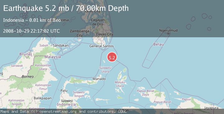
Earthquake KEPULAUAN TALAUD, INDONESIA
Wed, 29 Oct 2008 22:17:02 GMT
Time17 years ago
Location
4.1900, 126.6700
Depth
70.0 KM
Event Summary
A 5.2 magnitude earthquake struck on KEPULAUAN TALAUD, INDONESIA, at Wed, 29 Oct 2008 22:17:02 GMT. Depth: 70km. Reviewed by EMSC seismologists, this moderate quake occurred at a magnitude type of mb.
Magnitude
5.2
mb
Source
EMSC
Intensity
-
Agency Reports
1 Sources| Source | Magnitude | Depth | Time |
|---|---|---|---|
| EMSCPrimary | 5.2 | 70 km | 17 years ago |
Earthquake Details
AutomaticEvent IDemsc_EMSC_20081029_0000104
Tsunami PotentialNo
Magnitude Typemb
Nearest Places
- Pulau Nusamawawo9.8 km
- Tanjung Manubaru9.8 km
- Matahit9.9 km
- Tanjung Totonbatu10.1 km
- Tanjung Apretan10.2 km
Comments
Join the discussion about this event.
Latest Earthquakes
1.7Mag
2 km NW of Enterprise, Nevada
Time22 hours ago
Depth15.89 km
SourceUSGS (Automatic)
1.3Mag
Southeastern Alaska
Time22 hours ago
Depth7.20 km
SourceVYT (Automatic)
0.8Mag
39 km NE of Amboy, Washington
Time22 hours ago
Depth7.36 km
SourceUSGS (Automatic)
3.2Mag
ANDHRA PRADESH, INDIA
Time22 hours ago
Depth4.70 km
SourceNDI (Automatic)
0.7Mag
10 km WNW of The Geysers, CA
Time23 hours ago
Depth2.56 km
SourceUSGS (Automatic)
Nearby Earthquakes
5.6Mag
KEPULAUAN TALAUD, INDONESIA
Time5 years ago
Depth38.00 km
SourceEMSC (Automatic)
5.3Mag
KEPULAUAN TALAUD, INDONESIA
Time5 years ago
Depth40.00 km
SourceEMSC (Automatic)
5.1Mag
KEPULAUAN TALAUD, INDONESIA
Time8 years ago
Depth58.00 km
SourceEMSC (Automatic)
3.4Mag
KEPULAUAN TALAUD, INDONESIA
Time1 month ago
Depth73.00 km
SourceBMKG (Automatic)
2.9Mag
Talaud Islands, Indonesia
Time3 weeks ago
Depth39.53 km
SourceBMKG (Automatic)