Earthquake SAMOA ISLANDS REGION
Wed, 28 Jan 2009 12:39:41 GMT
Time17 years ago
Location
-16.9100, -172.1300
Depth
2.0 KM
Event Summary
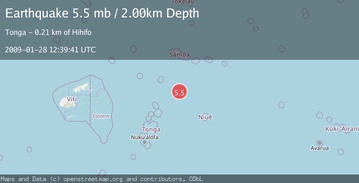
A 5.5 magnitude earthquake struck on SAMOA ISLANDS REGION, at Wed, 28 Jan 2009 12:39:41 GMT. Depth: 2km. Reviewed by EMSC seismologists, this moderate quake occurred at a magnitude type of mb.
Magnitude
5.5
mb
Source
EMSC
Intensity
-
Agency Reports
1 Sources| Source | Magnitude | Depth | Time |
|---|---|---|---|
| EMSCPrimary | 5.5 | 2 km | 17 years ago |
Earthquake Details
AutomaticEvent IDemsc_EMSC_20090128_0000067
Tsunami PotentialNo
Magnitude Typemb
Nearest Places
- 186.2 km
- 186.2 km
- 198.7 km
- 200.5 km
- 200.5 km
Comments
Join the discussion about this event.
Latest Earthquakes
2.7Mag
Minahasa, Sulawesi, Indonesia
Time4 minutes ago
Depth122.44 km
SourceVYT (Automatic)
2.7Mag
Greece-Albania border region
Time4 minutes ago
Depth0.00 km
SourceVYT (Automatic)
2.2Mag
NORTHERN CALIFORNIA
Time8 minutes ago
Depth2.90 km
SourceNC (Automatic)
2.5Mag
Antofagasta, Chile
Time9 minutes ago
Depth0.12 km
SourceVYT (Automatic)
1.3Mag
Tarapaca, Chile
Time11 minutes ago
Depth69.09 km
SourceVYT (Automatic)
Nearby Earthquakes
5.0Mag
TONGA REGION
Time18 years ago
Depth33.00 km
SourceEMSC (Automatic)
5.2Mag
SAMOA ISLANDS REGION
Time6 months ago
Depth13.30 km
SourceEMSC (Automatic)
5.0Mag
SAMOA ISLANDS REGION
Time6 years ago
Depth10.00 km
SourceEMSC (Automatic)
5.1Mag
SAMOA ISLANDS REGION
Time16 years ago
Depth10.00 km
SourceEMSC (Automatic)
5.0Mag
SAMOA ISLANDS REGION
Time2 years ago
Depth10.00 km
SourceEMSC (Automatic)