Earthquake KERMADEC ISLANDS, NEW ZEALAND
Tue, 17 Feb 2009 03:31:01 GMT
Time17 years ago
Location
-30.6200, -178.6200
Depth
60.0 KM
Event Summary
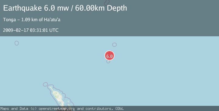
A 6.0 magnitude earthquake struck on KERMADEC ISLANDS, NEW ZEALAND, at Tue, 17 Feb 2009 03:31:01 GMT. Depth: 60km. Reviewed by EMSC seismologists, this strong quake occurred at a magnitude type of mw.
Magnitude
6.0
mw
Source
EMSC
Intensity
-
Agency Reports
1 Sources| Source | Magnitude | Depth | Time |
|---|---|---|---|
| EMSCPrimary | 6.0 | 60 km | 17 years ago |
Earthquake Details
AutomaticEvent IDemsc_EMSC_20090217_0000092
Tsunami PotentialNo
Magnitude Typemw
Nearest Places
- Macdonald Cove10.3 km
- Cheeseman Island10.6 km
- Curtis Island10.6 km
- Stella Passage10.9 km
- Kermadec Ridge17.6 km
Comments
Join the discussion about this event.
Latest Earthquakes
2.1Mag
Tarapaca, Chile
Time1 minute ago
Depth106.08 km
SourceVYT (Automatic)
1.4Mag
Southern Alaska
Time5 minutes ago
Depth28.32 km
SourceVYT (Automatic)
2.4Mag
northwestern Russia
Time5 minutes ago
Depth10.00 km
SourceVYT (Automatic)
2.3Mag
FRANCE
Time6 minutes ago
Depth5.00 km
SourceReNaSS (Automatic)
2.5Mag
Java, Indonesia
Time12 minutes ago
Depth14.16 km
SourceVYT (Automatic)
Nearby Earthquakes
5.0Mag
KERMADEC ISLANDS, NEW ZEALAND
Time16 years ago
Depth400.00 km
SourceEMSC (Automatic)
6.2Mag
KERMADEC ISLANDS, NEW ZEALAND
Time8 years ago
Depth10.00 km
SourceEMSC (Automatic)
4.6Mag
KERMADEC ISLANDS, NEW ZEALAND
Time1 month ago
Depth10.00 km
SourceNEIC (Automatic)
5.5Mag
KERMADEC ISLANDS, NEW ZEALAND
Time4 years ago
Depth324.00 km
SourceEMSC (Automatic)
5.2Mag
KERMADEC ISLANDS, NEW ZEALAND
Time2 years ago
Depth9.90 km
SourceEMSC (Automatic)