Earthquake MOLUCCA SEA
Mon, 20 Jul 2009 15:19:49 GMT
Time16 years ago
Location
2.3500, 126.9900
Depth
46.0 KM
Event Summary
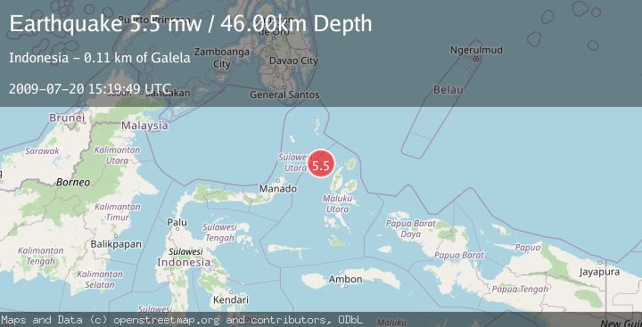
A 5.5 magnitude earthquake struck on MOLUCCA SEA, at Mon, 20 Jul 2009 15:19:49 GMT. Depth: 46km. Reviewed by EMSC seismologists, this moderate quake occurred at a magnitude type of mw.
Magnitude
5.5
mw
Source
EMSC
Intensity
-
Agency Reports
1 Sources| Source | Magnitude | Depth | Time |
|---|---|---|---|
| EMSCPrimary | 5.5 | 46 km | 16 years ago |
Earthquake Details
AutomaticEvent IDemsc_EMSC_20090720_0000055
Tsunami PotentialNo
Magnitude Typemw
Nearest Places
- Pulau Laba81.9 km
- Tanjung Gurama83.0 km
- Pulau Deherete83.9 km
- Desa Jikolamo84.5 km
- Jikolamo85.2 km
Comments
Join the discussion about this event.
Latest Earthquakes
1.9Mag
Poland
Time15 hours ago
Depth5.25 km
SourceVYT (Automatic)
2.0Mag
Central California
Time15 hours ago
Depth0.00 km
SourceVYT (Automatic)
0.7Mag
4 km NW of The Geysers, CA
Time15 hours ago
Depth3.05 km
SourceUSGS (Automatic)
2.7Mag
northern Colombia
Time15 hours ago
Depth73.00 km
SourceVYT (Automatic)
1.8Mag
2 km SW of Pāhala, Hawaii
Time15 hours ago
Depth29.79 km
SourceUSGS (Automatic)
Nearby Earthquakes
5.3Mag
MOLUCCA SEA
Time19 years ago
Depth60.00 km
SourceEMSC (Automatic)
3.0Mag
MOLUCCA SEA
Time1 year ago
Depth61.00 km
SourceBMKG (Automatic)
5.1Mag
MOLUCCA SEA
Time2 years ago
Depth53.00 km
SourceEMSC (Automatic)
3.0Mag
MOLUCCA SEA
Time2 years ago
Depth12.00 km
SourceBMKG (Automatic)
5.0Mag
MOLUCCA SEA
Time6 years ago
Depth30.00 km
SourceEMSC (Automatic)