Earthquake PHILIPPINE ISLANDS REGION
Tue, 17 Nov 2009 00:39:10 GMT
Time16 years ago
Location
5.8800, 127.0100
Depth
115.0 KM
Event Summary
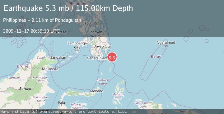
A 5.3 magnitude earthquake struck on PHILIPPINE ISLANDS REGION, at Tue, 17 Nov 2009 00:39:10 GMT. Depth: 115km. Reviewed by EMSC seismologists, this moderate quake occurred at a magnitude type of mb.
Magnitude
5.3
mb
Source
EMSC
Intensity
-
Agency Reports
1 Sources| Source | Magnitude | Depth | Time |
|---|---|---|---|
| EMSCPrimary | 5.3 | 115 km | 16 years ago |
Earthquake Details
AutomaticEvent IDemsc_EMSC_20091117_0000001
Tsunami PotentialNo
Magnitude Typemb
Nearest Places
- Tanjung Dapapa58.2 km
- Desa Pulau Miangas59.2 km
- Pulau Miangas59.3 km
- Kecamatan Miangas59.3 km
- Miangas60.0 km
Comments
Join the discussion about this event.
Latest Earthquakes
5.0Mag
Fox Islands, Aleutian Islands, Alaska
Time5 minutes ago
Depth0.00 km
SourceVYT (Automatic)
3.4Mag
southern Peru
Time8 minutes ago
Depth204.47 km
SourceVYT (Automatic)
2.1Mag
SAN FRANCISCO BAY AREA, CALIF.
Time11 minutes ago
Depth6.40 km
SourceNC (Automatic)
2.4Mag
Fox Islands, Aleutian Islands, Alaska
Time11 minutes ago
Depth44.43 km
SourceVYT (Automatic)
2.4Mag
British Columbia, Canada
Time11 minutes ago
Depth3.91 km
SourceVYT (Automatic)
Nearby Earthquakes
3.0Mag
PHILIPPINE ISLANDS REGION
Time3 months ago
Depth102.00 km
SourcePIVS (Automatic)
3.1Mag
PHILIPPINE ISLANDS REGION
Time1 month ago
Depth14.00 km
SourcePIVS (Automatic)
5.4Mag
PHILIPPINE ISLANDS REGION
Time13 years ago
Depth142.00 km
SourceEMSC (Automatic)
3.0Mag
PHILIPPINE ISLANDS REGION
Time4 years ago
Depth119.00 km
SourcePIVS (Automatic)
4.0Mag
PHILIPPINE ISLANDS REGION
Time4 years ago
Depth65.00 km
SourceNEIC (Automatic)