Earthquake SOUTH OF KERMADEC ISLANDS
Sun, 17 Jan 2010 22:38:19 GMT
Time16 years ago
Location
-32.0300, -177.7200
Depth
40.0 KM
Event Summary
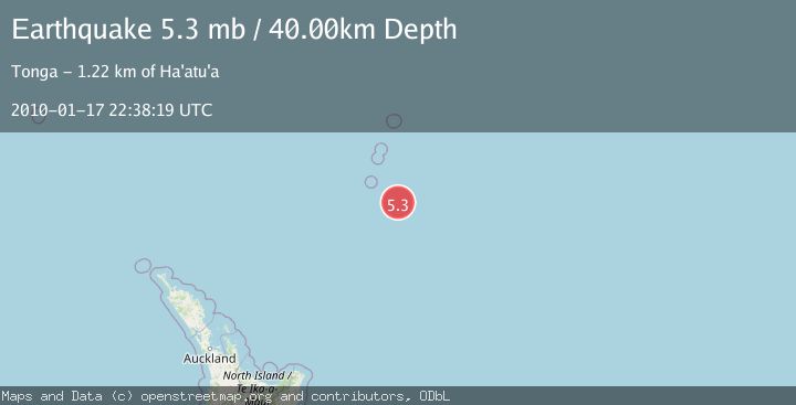
A 5.3 magnitude earthquake struck on SOUTH OF KERMADEC ISLANDS, at Sun, 17 Jan 2010 22:38:19 GMT. Depth: 40km. Reviewed by EMSC seismologists, this moderate quake occurred at a magnitude type of mb.
Magnitude
5.3
mb
Source
EMSC
Intensity
-
Agency Reports
1 Sources| Source | Magnitude | Depth | Time |
|---|---|---|---|
| EMSCPrimary | 5.3 | 40 km | 16 years ago |
Earthquake Details
AutomaticEvent IDemsc_EMSC_20100117_0000049
Tsunami PotentialNo
Magnitude Typemb
Nearest Places
- 39.7 km
- 85.2 km
- 129.8 km
- 136.8 km
- 142.8 km
Comments
Join the discussion about this event.
Latest Earthquakes
2.2Mag
Tarapaca, Chile
Time9 minutes ago
Depth112.92 km
SourceVYT (Automatic)
1.4Mag
Southern Alaska
Time13 minutes ago
Depth64.58 km
SourceVYT (Automatic)
2.7Mag
near the coast of southern Peru
Time15 minutes ago
Depth63.11 km
SourceVYT (Automatic)
1.3Mag
11 km WSW of Corona, CA
Time18 minutes ago
Depth5.43 km
SourceUSGS (Automatic)
1.5Mag
Northern Territory, Australia
Time21 minutes ago
Depth6.10 km
SourceVYT (Automatic)
Nearby Earthquakes
5.0Mag
KERMADEC ISLANDS REGION
Time8 years ago
Depth2.00 km
SourceEMSC (Automatic)
5.1Mag
KERMADEC ISLANDS REGION
Time14 years ago
Depth10.00 km
SourceEMSC (Automatic)
6.3Mag
KERMADEC ISLANDS REGION
Time6 years ago
Depth10.00 km
SourceEMSC (Automatic)
5.9Mag
SOUTH OF KERMADEC ISLANDS
Time6 years ago
Depth10.00 km
SourceEMSC (Automatic)
5.0Mag
KERMADEC ISLANDS REGION
Time3 years ago
Depth2.00 km
SourceEMSC (Automatic)