Earthquake TONGA
Sat, 13 Feb 2010 02:34:29 GMT
Time16 years ago
Location
-21.8500, -174.7600
Depth
10.0 KM
Event Summary
A 6.1 magnitude earthquake struck on TONGA, at Sat, 13 Feb 2010 02:34:29 GMT. Depth: 10km. Reviewed by EMSC seismologists, this strong quake occurred at a magnitude type of mw.
Magnitude
6.1
mw
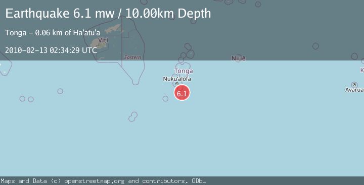
Source
EMSC
Intensity
-
Agency Reports
1 Sources| Source | Magnitude | Depth | Time |
|---|---|---|---|
| EMSCPrimary | 6.1 | 10 km | 16 years ago |
Earthquake Details
AutomaticEvent IDemsc_EMSC_20100213_0000004
Tsunami PotentialNo
Magnitude Typemw
Nearest Places
- 46.8 km
- 49.7 km
- 50.7 km
- 52.1 km
- 54.1 km
Comments
Join the discussion about this event.
Latest Earthquakes
2.3Mag
Timor Region
Time5 minutes ago
Depth39.70 km
SourceBMKG
1.6Mag
22 km SSW of Tahoma, CA
Time7 minutes ago
Depth0.83 km
SourceUSGS (Automatic)
4.3Mag
Banda Sea
Time7 minutes ago
Depth10.00 km
SourceVYT (Automatic)
2.2Mag
Sumbawa Region, Indonesia
Time7 minutes ago
Depth17.71 km
SourceBMKG
1.3Mag
Fox Islands, Aleutian Islands, Alaska
Time8 minutes ago
Depth5.25 km
SourceVYT (Automatic)
Nearby Earthquakes
5.9Mag
TONGA
Time4 years ago
Depth10.00 km
SourceEMSC (Automatic)
5.2Mag
TONGA
Time9 years ago
Depth10.00 km
SourceEMSC (Automatic)
5.4Mag
TONGA
Time3 weeks ago
Depth32.00 km
SourceEMSC (Automatic)
5.1Mag
TONGA
Time17 years ago
Depth2.00 km
SourceEMSC (Automatic)
5.2Mag
TONGA
Time9 years ago
Depth10.00 km
SourceNEIC (Automatic)