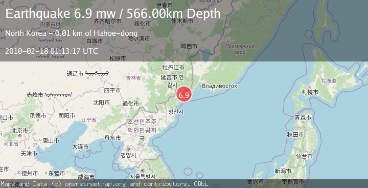
Earthquake CHINA-RUSSIA-NORTH KOREA BORDER
Thu, 18 Feb 2010 01:13:17 GMT
Time16 years ago
Location
42.6100, 130.5400
Depth
566.0 KM
Event Summary
A 6.9 magnitude earthquake struck on CHINA-RUSSIA-NORTH KOREA BORDER, at Thu, 18 Feb 2010 01:13:17 GMT. Depth: 566km. Reviewed by EMSC seismologists, this strong quake occurred at a magnitude type of mw.
Magnitude
6.9
mw
Source
EMSC
Intensity
-
Agency Reports
1 Sources| Source | Magnitude | Depth | Time |
|---|---|---|---|
| EMSCPrimary | 6.9 | 566 km | 16 years ago |
Earthquake Details
AutomaticEvent IDemsc_EMSC_20100218_0000001
Tsunami PotentialNo
Magnitude Typemw
Nearest Places
- 1.4 km
- 1.5 km
- 1.6 km
- 1.8 km
- 1.8 km
Comments
Join the discussion about this event.
Latest Earthquakes
1.2Mag
Central Alaska
Time2 minutes ago
Depth0.00 km
SourceVYT (Automatic)
2.3Mag
Timor Region
Time7 minutes ago
Depth39.70 km
SourceBMKG
1.6Mag
22 km SSW of Tahoma, CA
Time8 minutes ago
Depth0.83 km
SourceUSGS (Automatic)
4.3Mag
Banda Sea
Time8 minutes ago
Depth10.00 km
SourceVYT (Automatic)
2.2Mag
Sumbawa Region, Indonesia
Time8 minutes ago
Depth17.71 km
SourceBMKG
Nearby Earthquakes
5.8Mag
CHINA-RUSSIA-NORTH KOREA BORDER
Time12 years ago
Depth570.00 km
SourceEMSC (Automatic)
6.2Mag
E. RUSSIA-N.E. CHINA BORDER REG.
Time12 years ago
Depth551.00 km
SourceEMSC (Automatic)
5.2Mag
E. RUSSIA-N.E. CHINA BORDER REG.
Time3 months ago
Depth548.00 km
SourceEMSC (Automatic)
5.0Mag
JILIN-HEILONGJIANG BDR, CHINA
Time12 years ago
Depth553.00 km
SourceEMSC (Automatic)
5.3Mag
JILIN-HEILONGJIANG BDR, CHINA
Time14 years ago
Depth550.00 km
SourceEMSC (Automatic)