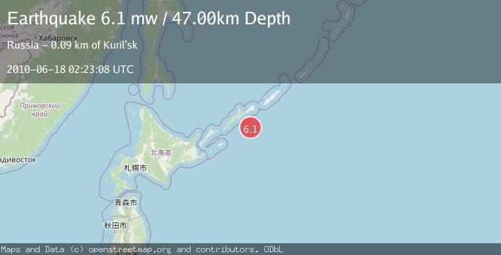
Earthquake KURIL ISLANDS
Fri, 18 Jun 2010 02:23:08 GMT
Time15 years ago
Location
44.5700, 148.6300
Depth
47.0 KM
Event Summary
A 6.1 magnitude earthquake struck on KURIL ISLANDS, at Fri, 18 Jun 2010 02:23:08 GMT. Depth: 47km. Reviewed by EMSC seismologists, this strong quake occurred at a magnitude type of mw.
Magnitude
6.1
mw
Source
EMSC
Intensity
-
Agency Reports
1 Sources| Source | Magnitude | Depth | Time |
|---|---|---|---|
| EMSCPrimary | 6.1 | 47 km | 15 years ago |
Earthquake Details
AutomaticEvent IDemsc_EMSC_20100618_0000005
Tsunami PotentialNo
Magnitude Typemw
Nearest Places
- 70.6 km
- 70.8 km
- 70.9 km
- 71.4 km
- 71.5 km
Comments
Join the discussion about this event.
Latest Earthquakes
2.0Mag
Alaska Peninsula
Time1 minute ago
Depth0.61 km
SourceVYT (Automatic)
0.8Mag
Northern Territory, Australia
Time6 minutes ago
Depth24.29 km
SourceVYT (Automatic)
2.2Mag
South Australia
Time7 minutes ago
Depth242.19 km
SourceVYT (Automatic)
1.8Mag
Southern Alaska
Time7 minutes ago
Depth60.18 km
SourceVYT (Automatic)
3.9Mag
Tarapaca, Chile
Time11 minutes ago
Depth92.77 km
SourceVYT (Automatic)
Nearby Earthquakes
4.0Mag
KURIL ISLANDS
Time2 years ago
Depth50.00 km
SourceGSRAS (Automatic)
5.2Mag
KURIL ISLANDS
Time18 years ago
Depth40.00 km
SourceEMSC (Automatic)
4.9Mag
KURIL ISLANDS
Time2 weeks ago
Depth50.00 km
SourceEMSC (Automatic)
5.1Mag
KURIL ISLANDS
Time17 years ago
Depth50.00 km
SourceEMSC (Automatic)
6.2Mag
KURIL ISLANDS
Time11 years ago
Depth60.00 km
SourceEMSC (Automatic)