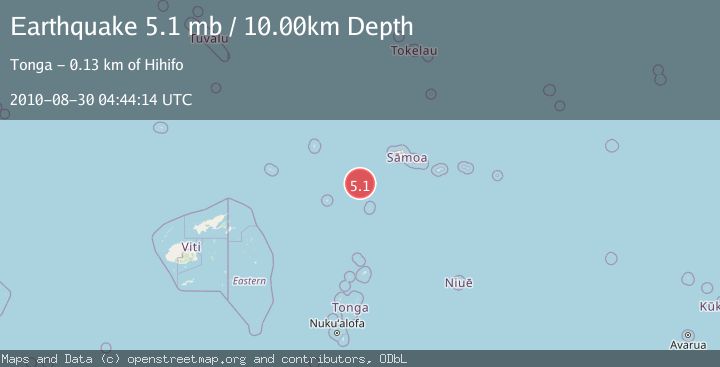
Earthquake SAMOA ISLANDS REGION
Mon, 30 Aug 2010 04:44:14 GMT
Time15 years ago
Location
-14.8800, -174.1600
Depth
10.0 KM
Event Summary
A 5.1 magnitude earthquake struck on SAMOA ISLANDS REGION, at Mon, 30 Aug 2010 04:44:14 GMT. Depth: 10km. Reviewed by EMSC seismologists, this moderate quake occurred at a magnitude type of mb.
Magnitude
5.1
mb
Source
EMSC
Intensity
-
Agency Reports
1 Sources| Source | Magnitude | Depth | Time |
|---|---|---|---|
| EMSCPrimary | 5.1 | 10 km | 15 years ago |
Earthquake Details
AutomaticEvent IDemsc_EMSC_20100830_0000013
Tsunami PotentialNo
Magnitude Typemb
Nearest Places
- 90.6 km
- 117.0 km
- 121.9 km
- 124.5 km
- 125.3 km
Comments
Join the discussion about this event.
Latest Earthquakes
1.5Mag
17 km SSE of Mammoth Lakes, CA
Time5 minutes ago
Depth3.16 km
SourceUSGS (Automatic)
1.1Mag
Southeastern Alaska
Time11 minutes ago
Depth0.00 km
SourceVYT (Automatic)
0.6Mag
10 km NE of Julian, CA
Time12 minutes ago
Depth5.27 km
SourceUSGS (Automatic)
3.3Mag
Fox Islands, Aleutian Islands, Alaska
Time12 minutes ago
Depth18.55 km
SourceVYT (Automatic)
2.4Mag
Western Australia
Time13 minutes ago
Depth511.84 km
SourceVYT (Automatic)
Nearby Earthquakes
5.0Mag
SAMOA ISLANDS REGION
Time9 years ago
Depth10.00 km
SourceEMSC (Automatic)
5.2Mag
TONGA
Time4 years ago
Depth126.00 km
SourceEMSC (Automatic)
5.1Mag
TONGA
Time15 years ago
Depth10.00 km
SourceEMSC (Automatic)
5.9Mag
TONGA
Time17 years ago
Depth142.00 km
SourceEMSC (Automatic)
5.3Mag
SAMOA ISLANDS REGION
Time9 years ago
Depth10.00 km
SourceEMSC (Automatic)