Earthquake EAST OF KURIL ISLANDS
Fri, 18 Feb 2011 20:20:33 GMT
Time15 years ago
Location
44.8900, 150.1000
Depth
60.0 KM
Event Summary
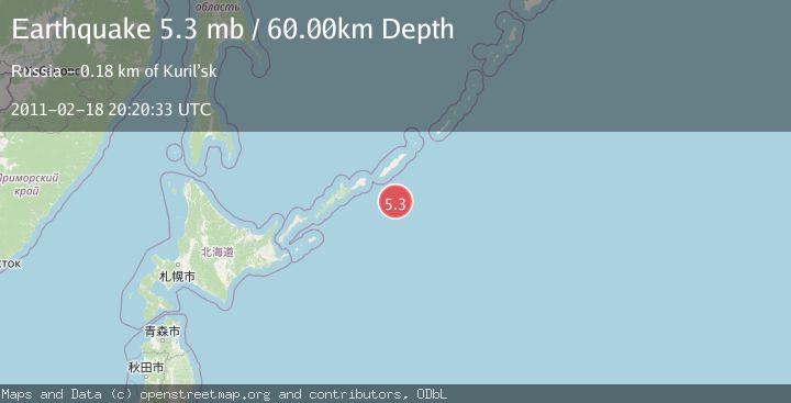
A 5.3 magnitude earthquake struck on EAST OF KURIL ISLANDS, at Fri, 18 Feb 2011 20:20:33 GMT. Depth: 60km. Reviewed by EMSC seismologists, this moderate quake occurred at a magnitude type of mb.
Magnitude
5.3
mb
Source
EMSC
Intensity
-
Agency Reports
1 Sources| Source | Magnitude | Depth | Time |
|---|---|---|---|
| EMSCPrimary | 5.3 | 60 km | 15 years ago |
Earthquake Details
AutomaticEvent IDemsc_EMSC_20110218_0000036
Tsunami PotentialNo
Magnitude Typemb
Nearest Places
- 87.6 km
- 87.7 km
- 88.2 km
- 88.3 km
- 88.3 km
Comments
Join the discussion about this event.
Latest Earthquakes
2.5Mag
Poland
Time2 minutes ago
Depth7.08 km
SourceVYT (Automatic)
1.7Mag
2 km SSE of Redwood Valley, CA
Time4 minutes ago
Depth6.34 km
SourceUSGS (Automatic)
3.1Mag
south of Alaska
Time8 minutes ago
Depth10.00 km
SourceVYT (Automatic)
3.3Mag
JUJUY, ARGENTINA
Time9 minutes ago
Depth244.00 km
SourceNSNA (Automatic)
3.6Mag
Papua, Indonesia
Time14 minutes ago
Depth0.12 km
SourceVYT (Automatic)
Nearby Earthquakes
5.0Mag
EAST OF KURIL ISLANDS
Time10 years ago
Depth52.00 km
SourceEMSC (Automatic)
5.0Mag
EAST OF KURIL ISLANDS
Time14 years ago
Depth40.00 km
SourceEMSC (Automatic)
5.5Mag
EAST OF KURIL ISLANDS
Time19 years ago
Depth60.00 km
SourceEMSC (Automatic)
5.4Mag
KURIL ISLANDS
Time8 years ago
Depth60.00 km
SourceEMSC (Automatic)
5.6Mag
KURIL ISLANDS
Time2 years ago
Depth55.00 km
SourceEMSC (Automatic)