Earthquake NORTH OF HALMAHERA, INDONESIA
Tue, 13 Dec 2011 01:20:45 GMT
Time14 years ago
Location
3.0000, 128.3100
Depth
111.0 KM
Event Summary
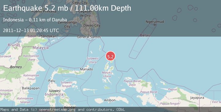
A 5.2 magnitude earthquake struck on NORTH OF HALMAHERA, INDONESIA, at Tue, 13 Dec 2011 01:20:45 GMT. Depth: 111km. Reviewed by EMSC seismologists, this moderate quake occurred at a magnitude type of mb.
Magnitude
5.2
mb
Source
EMSC
Intensity
-
Agency Reports
1 Sources| Source | Magnitude | Depth | Time |
|---|---|---|---|
| EMSCPrimary | 5.2 | 111 km | 14 years ago |
Earthquake Details
AutomaticEvent IDemsc_EMSC_20111213_0000004
Tsunami PotentialNo
Magnitude Typemb
Nearest Places
- Morotai Basin34.4 km
- Tanjung Padangi48.2 km
- Tanjung Sopi48.9 km
- Kakaibabao49.1 km
- Tanjung Berri Berri49.4 km
Comments
Join the discussion about this event.
Latest Earthquakes
1.6Mag
Southern Alaska
Time11 minutes ago
Depth48.58 km
SourceVYT (Automatic)
2.2Mag
PUERTO RICO
Time13 minutes ago
Depth13.80 km
SourcePR (Automatic)
2.3Mag
Antofagasta, Chile
Time13 minutes ago
Depth82.15 km
SourceVYT (Automatic)
2.1Mag
Southern Alaska
Time16 minutes ago
Depth64.21 km
SourceVYT (Automatic)
2.5Mag
Central Alaska
Time21 minutes ago
Depth312.99 km
SourceVYT (Automatic)
Nearby Earthquakes
4.0Mag
HALMAHERA, INDONESIA
Time1 year ago
Depth14.00 km
SourceBMKG (Automatic)
5.5Mag
NORTH OF HALMAHERA, INDONESIA
Time16 years ago
Depth30.00 km
SourceEMSC (Automatic)
6.4Mag
HALMAHERA, INDONESIA
Time5 years ago
Depth105.00 km
SourceEMSC (Automatic)
4.0Mag
NORTH OF HALMAHERA, INDONESIA
Time11 months ago
Depth186.00 km
SourceBMKG (Automatic)
4.0Mag
HALMAHERA, INDONESIA
Time3 years ago
Depth203.00 km
SourceDJA (Automatic)