Earthquake SAMAR, PHILIPPINES
Tue, 17 Jan 2012 12:55:36 GMT
Time14 years ago
Location
11.1900, 125.9200
Depth
30.0 KM
Event Summary
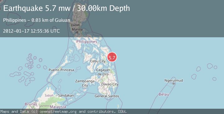
A 5.7 magnitude earthquake struck on SAMAR, PHILIPPINES, at Tue, 17 Jan 2012 12:55:36 GMT. Depth: 30km. Reviewed by EMSC seismologists, this moderate quake occurred at a magnitude type of mw.
Magnitude
5.7
mw
Source
EMSC
Intensity
-
Agency Reports
1 Sources| Source | Magnitude | Depth | Time |
|---|---|---|---|
| EMSCPrimary | 5.7 | 30 km | 14 years ago |
Earthquake Details
AutomaticEvent IDemsc_EMSC_20120117_0000040
Tsunami PotentialNo
Magnitude Typemw
Nearest Places
- 23.2 km
- 23.6 km
- 23.7 km
- 24.0 km
- 24.3 km
Comments
Join the discussion about this event.
Latest Earthquakes
2.1Mag
Flores Sea
Time2 minutes ago
Depth31.91 km
SourceBMKG
1.8Mag
3 km WSW of Boulder City, Nevada
Time13 minutes ago
Depth10.39 km
SourceUSGS (Automatic)
1.9Mag
WESTERN TURKEY
Time15 minutes ago
Depth7.80 km
SourceAFAD (Automatic)
2.9Mag
Sulawesi, Indonesia
Time17 minutes ago
Depth0.98 km
SourceVYT (Automatic)
3.3Mag
Southern Alaska
Time18 minutes ago
Depth98.27 km
SourceVYT (Automatic)
Nearby Earthquakes
5.4Mag
SAMAR, PHILIPPINES
Time3 years ago
Depth35.00 km
SourceEMSC (Automatic)
4.0Mag
SAMAR, PHILIPPINES
Time2 years ago
Depth48.70 km
SourceNEIC (Automatic)
5.4Mag
PHILIPPINE ISLANDS REGION
Time7 years ago
Depth30.00 km
SourceEMSC (Automatic)
3.0Mag
SAMAR, PHILIPPINES
Time1 year ago
Depth25.00 km
SourcePIVS (Automatic)
5.1Mag
PHILIPPINE ISLANDS REGION
Time14 years ago
Depth31.00 km
SourceEMSC (Automatic)