Earthquake SOUTH OF KERMADEC ISLANDS
Sun, 26 Feb 2012 05:24:54 GMT
Time13 years ago
Location
-32.4400, -177.6600
Depth
5.0 KM
Event Summary
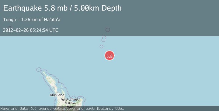
A 5.8 magnitude earthquake struck on SOUTH OF KERMADEC ISLANDS, at Sun, 26 Feb 2012 05:24:54 GMT. Depth: 5km. Reviewed by EMSC seismologists, this moderate quake occurred at a magnitude type of mb.
Magnitude
5.8
mb
Source
EMSC
Intensity
-
Agency Reports
1 Sources| Source | Magnitude | Depth | Time |
|---|---|---|---|
| EMSCPrimary | 5.8 | 5 km | 13 years ago |
Earthquake Details
AutomaticEvent IDemsc_EMSC_20120226_0000033
Tsunami PotentialNo
Magnitude Typemb
Nearest Places
- 59.5 km
- 99.4 km
- 132.3 km
- 135.2 km
- 142.8 km
Comments
Join the discussion about this event.
Latest Earthquakes
1.0Mag
7 km WSW of Corona, CA
Time4 hours ago
Depth4.55 km
SourceUSGS (Automatic)
1.5Mag
Northern Territory, Australia
Time4 hours ago
Depth6.10 km
SourceVYT (Automatic)
2.3Mag
Central Alaska
Time4 hours ago
Depth0.00 km
SourceVYT (Automatic)
2.4Mag
OFFSHORE NORTHERN CALIFORNIA
Time4 hours ago
Depth6.00 km
SourceNC (Automatic)
2.2Mag
northwestern Russia
Time4 hours ago
Depth0.00 km
SourceVYT (Automatic)
Nearby Earthquakes
5.2Mag
SOUTH OF KERMADEC ISLANDS
Time10 years ago
Depth10.00 km
SourceEMSC (Automatic)
5.6Mag
SOUTH OF KERMADEC ISLANDS
Time9 years ago
Depth10.00 km
SourceEMSC (Automatic)
5.2Mag
SOUTH OF KERMADEC ISLANDS
Time3 years ago
Depth2.00 km
SourceEMSC (Automatic)
5.4Mag
SOUTH OF KERMADEC ISLANDS
Time1 year ago
Depth26.00 km
SourceEMSC (Automatic)
5.1Mag
SOUTH OF KERMADEC ISLANDS
Time1 year ago
Depth10.00 km
SourceEMSC (Automatic)