Earthquake NEAR N COAST OF PAPUA, INDONESIA
Mon, 16 Jul 2012 16:33:09 GMT
Time13 years ago
Location
-1.2900, 137.1000
Depth
10.0 KM
Event Summary
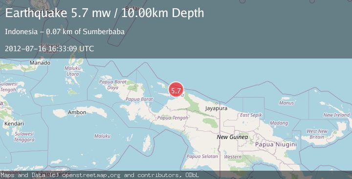
A 5.7 magnitude earthquake struck on NEAR N COAST OF PAPUA, INDONESIA, at Mon, 16 Jul 2012 16:33:09 GMT. Depth: 10km. Reviewed by EMSC seismologists, this moderate quake occurred at a magnitude type of mw.
Magnitude
5.7
mw
Source
EMSC
Intensity
-
Agency Reports
1 Sources| Source | Magnitude | Depth | Time |
|---|---|---|---|
| EMSCPrimary | 5.7 | 10 km | 13 years ago |
Earthquake Details
AutomaticEvent IDemsc_EMSC_20120716_0000056
Tsunami PotentialNo
Magnitude Typemw
Nearest Places
- 40.4 km
- 44.4 km
- 45.0 km
- 45.1 km
- 47.4 km
Comments
Join the discussion about this event.
Latest Earthquakes
2.0Mag
Valparaiso, Chile
Time2 hours ago
Depth4.64 km
SourceVYT (Automatic)
1.4Mag
Kodiak Island region, Alaska
Time2 hours ago
Depth47.12 km
SourceVYT (Automatic)
2.1Mag
NEVADA
Time2 hours ago
Depth4.90 km
SourceNN (Automatic)
4.6Mag
Rat Islands, Aleutian Islands, Alaska
Time2 hours ago
Depth10.00 km
SourceVYT (Automatic)
1.3Mag
11 km NW of Pinnacles, CA
Time2 hours ago
Depth8.23 km
SourceUSGS (Automatic)
Nearby Earthquakes
4.0Mag
BIAK REGION, INDONESIA
Time3 years ago
Depth10.00 km
SourceDJA (Automatic)
5.4Mag
BIAK REGION, INDONESIA
Time3 years ago
Depth10.00 km
SourceEMSC (Automatic)
2.8Mag
BIAK REGION, INDONESIA
Time1 month ago
Depth10.00 km
SourceBMKG (Automatic)
3.6Mag
NEAR N COAST OF PAPUA, INDONESIA
Time2 months ago
Depth10.00 km
SourceBMKG (Automatic)
3.0Mag
BIAK REGION, INDONESIA
Time3 years ago
Depth10.00 km
SourceDJA (Automatic)