Earthquake SOUTH OF JAVA, INDONESIA
Mon, 03 Sep 2012 18:23:04 GMT
Time13 years ago
Location
-10.8500, 113.9100
Depth
10.0 KM
Event Summary
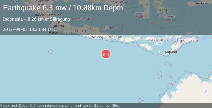
A 6.3 magnitude earthquake struck on SOUTH OF JAVA, INDONESIA, at Mon, 03 Sep 2012 18:23:04 GMT. Depth: 10km. Reviewed by EMSC seismologists, this strong quake occurred at a magnitude type of mw.
Magnitude
6.3
mw
Source
EMSC
Intensity
-
Agency Reports
1 Sources| Source | Magnitude | Depth | Time |
|---|---|---|---|
| EMSCPrimary | 6.3 | 10 km | 13 years ago |
Earthquake Details
AutomaticEvent IDemsc_EMSC_20120903_0000058
Tsunami PotentialNo
Magnitude Typemw
Nearest Places
- 234.1 km
- 236.6 km
- 237.0 km
- 237.0 km
- 237.1 km
Comments
Join the discussion about this event.
Latest Earthquakes
0.7Mag
9 km NW of The Geysers, CA
Time14 hours ago
Depth1.84 km
SourceUSGS (Automatic)
2.6Mag
Java, Indonesia
Time14 hours ago
Depth30.60 km
SourceBMKG
2.9Mag
Off West Coast of Northern Sumatra
Time14 hours ago
Depth1.82 km
SourceBMKG
3.3Mag
western Texas
Time14 hours ago
Depth0.00 km
SourceVYT (Automatic)
2.2Mag
Minahassa Peninsula, Sulawesi
Time14 hours ago
Depth86.43 km
SourceBMKG
Nearby Earthquakes
5.0Mag
SOUTH OF JAVA, INDONESIA
Time13 years ago
Depth15.00 km
SourceEMSC (Automatic)
5.2Mag
SOUTH OF JAVA, INDONESIA
Time13 years ago
Depth30.00 km
SourceEMSC (Automatic)
5.2Mag
SOUTH OF JAVA, INDONESIA
Time13 years ago
Depth30.00 km
SourceEMSC (Automatic)
5.8Mag
SOUTH OF JAVA, INDONESIA
Time13 years ago
Depth10.00 km
SourceEMSC (Automatic)
5.0Mag
SOUTH OF JAVA, INDONESIA
Time13 years ago
Depth30.00 km
SourceEMSC (Automatic)